What is recorded here
Knocknagapple holds a faint fourteen-metre arc, the last visible ridge of an earthen ringfort that men and women shaped before roads cut through its southern half. It appeared on a 1773-4 map by B. Scalé, meaning the community still recognised the boundary enough to draw it, even though pasture and ploughing had already softened its edges. The name Fairy fort suggests people believed the site belonged elsewhere, that ordinary ownership stopped at its rim. What remains is a low curve in a north-facing slope, quiet enough to drive across yet old enough to have outlasted the fields around it.
In pasture, on a gentle N-facing slope. Indicated on a 1773-4 map (no. 23) by B. Scalé (NLI MSS 7216-18). A barely discernible ridge extends in a slight arc (L 14m E-W), which may be the N sector remnants of the bank of the possible rath. A field boundary indicated on the 1935 OS 6-inch map immediately to the NW has been removed and there is a farm roadway running roughly E-W across the levelled S half of the monument.
The above description is derived from 'The Archaeological Inventory of County Cork. Volume 5' (Dublin: Stationery Office, 2009).
Date of upload: 22 December 2009
A fairy fort or earthen ringfort in Knocknagapple, likely dating to the early medieval period, is marked on a 1773–1774 map and shows faint remains of a bank. Local tradition may associate it with fairy lore, as suggested by its name.
This remains an important historical record, but the official description says the monument is no longer visible or has been destroyed. The monument record does not grant public access. Check the route and ask the landowner before entering private land.
- What survives
- No visible remains or recorded as destroyed
Places near here
 St Bridgets WellHoly well · 965 yd
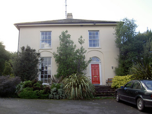 Brideweir Houserectory/glebe/vicarage/curate's house · 1121 yd
 Douglas Villahouse · 1171 yd
 Aghern CastleCastle · 1361 yd
 Aghern CemeteryWood · 1412 yd
 Castle (in Ruins)Castle, tower house · 1477 yd
 Folacht FiadhFulacht fia · 1480 yd
 Graveyard in KillasseraghGraveyard · 3.2 mi
 Rathcormac massacremassacre · 4.7 mi
 Strawhall WoodForest · 4.9 mi
 Salt HillMountain / peak · 5.1 mi
 Old Railway ViaductViewpoint · 6.0 mi