What is recorded here
Inchafune holds a broken earthen ring on a natural rise, its southwest gap wide enough for carts or ghosts. The bank still stands, though grass has softened its edges and pasture now crosses the site. People may have lived inside, watched the land, or abandoned the place when ownership changed. The gap refuses to be an oversight because it points toward movement, entry, and the life that once used it.
In pasture, atop natural rise. Circular raised area (32m N-S; 34m E-W) enclosed by earthen bank (int. H 0.8m; ext.H 1.8m). Break in bank to SW (Wth 12m), surface slopes gently down from interior to outer ground level. Site adjoins E side of N-S field fence.
The above description is derived from the published 'Archaeological Inventory of County Cork. Volume 1: West Cork' (Dublin: Stationery Office, 1992). In certain instances the entries have been revised and updated in the light of recent research.
Date of upload/revision: 14 January 2009
The monument record does not grant public access. Check the route and ask the landowner before entering private land.
- What survives
- Recorded monument
Places near here
 Clubhouse Bridgebridge · 1231 yd
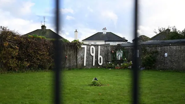 Children's burial ground in InchafuneChildren's burial ground · 1360 yd
 Bealanascartane Bridgebridge · 1.1 mi
 Pit in BallyhalwickPit · 1.2 mi
 Ballynacarriga CastleCastle, tower house · 1.3 mi
 Graveyard in Dunmanway NorthGraveyard · 2.3 mi
 Mohona WoodWood · 2.4 mi
 Dunmanway Heritage CentreVisitor information · 2.5 mi
 Castle (Site of)Castle, Anglo-Norman masonry castle · 2.6 mi
 Irish National Forestry FoundationNature reserve · 3.1 mi
 Mount GunneryMountain / peak · 3.5 mi
 Funmanway Adventure LandHeritage attraction · 3.7 mi