What is recorded here
Fairy fort in Glenmore, County Longford: a circular earthen enclosure marked ‘Fort’ on the 1837 Ordnance Survey map, now hidden beneath pasture on a low rise. It may have been a boundary marker, a seasonal shelter, or a child’s fort built from river clay and forgotten when the fields changed. The fairness in its name suggests people once placed it beside myth rather than measurement, as if the earth itself had made a room and stopped answering questions.
On a low rise in well-drained pasture. Depicted as a circular enclosure with the designation 'Fort' on the 1837 ed. of the OS 6-inch map. The monument is not visible at ground level.
Compiled by: Patrick F. O'Donovan
Date of upload: 26 August 2011
The monument record does not grant public access. Check the route and ask the landowner before entering private land.
- What survives
- Recorded monument
Places near here
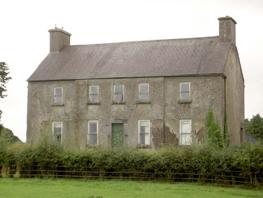 Glenmore Househouse · 528 yd
 KilnKiln, lime · 917 yd
 Enclosure in Glenmore (moydow By.)Enclosure · 1085 yd
 IndicatedFairy fort / earthen ringfort · 1139 yd
 CastleCastle, unclassified · 1.4 mi
 Bawn in BallyknockBawn · 1.8 mi
 Corlea Bog Walk Canal BranchWalking route · 2.0 mi
 Corlea Trackway Interpretative CentreHeritage attraction · 2.2 mi
 Corlea Bog Walk Blue LoopWalking route · 2.4 mi
 Graveyard in Curry (ardagh By., Coolamber Ed)Graveyard · 4.6 mi
 Leveret IslandIslet · 6.9 mi
 InchbofinIslet · 7.8 mi