What is recorded here
Two flat slabs lie buried in West Cork, one marked by a mysterious drill-hole. They are not standing proud but resting low beside a nearby stone row, waiting for someone to explain why they were cut and placed together.
This 'standing stone - pair' is referred to in the 'Archaeological Inventory of County Cork - vol. 1 West Cork' (1992, 35) under the entry (no. 148) for a nearby stone row (CO114-010001-). The reference to the standing stone pair in the entry reads: 'To SE are two prostrate slabs (CO114-010002-) measuring 1.7m by 0.95m in maximum dimension, one of which has a drill-hole on its upper surface. (Ó Nualláin 1988, 236, no. 43)'
The above description is derived from the published 'Archaeological Inventory of County Cork. Volume 1: West Cork' (Dublin: Stationery Office, 1992). In certain instances the entries have been revised and updated in the light of recent research.
Date of upload/revision: 14 January 2009
Likely dating to the Neolithic or early Bronze Age, the pair of standing stones in Eyeries may have been part of a ritual or ceremonial landscape associated with the nearby stone row. Such stones often held symbolic or astronomical significance, possibly marking territorial boundaries or serving as focal points for communal gatherings.
The monument record does not grant public access. Check the route and ask the landowner before entering private land.
- What survives
- Recorded monument
Places near here
 garda station/constabulary barracksgarda station/constabulary barracks · 438 yd
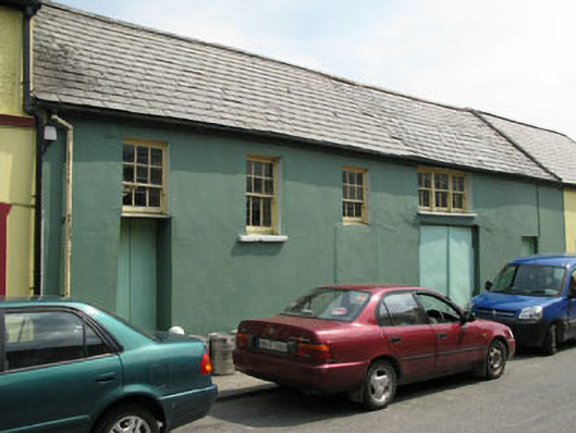 workshopworkshop · 445 yd
 Eyeries - Creha Quay LoopWalking route · 592 yd
 Wild Atlantic WayVisitor information · 690 yd
 Eyeries - Coastguard Station LoopWalking route · 1006 yd
 Pallas StrandBeach / strand · 1046 yd
 CarrigleamoreIslet · 1213 yd
 The BullIslet · 1228 yd
 Wedge tomb in BofickilWedge tomb · 1703 yd
 Field boundary in Inches (bear By.)Field boundary · 1.1 mi
 Miskish MountainMountain / peak · 1.5 mi
 TrabaneBeach / strand · 2.1 mi