
What is recorded here
On a SE-facing slope, at the SSE end of a low but pronounced ridge and below the crest of low gently undulating hill, in pasture. There are good views to the E and S but views are impeded by rising ground to the N and W. Identified on a Geological Survey of Ireland aerial photograph (roll 43, print 14). A circular area (diam. 33.5m) defined by a bank (Wth at crest 1.8m; overall Wth 5-7.5m; int. H 0.4-1.6m; ext. H 0.35-0.8m) with a very high stone content. There is stone protruding from the bank for much of its circuit suggesting that this monument may have been stone walled originally, with tumble producing quite a wide bank spread. The monument is grass-covered. There is no clear evidence of a fosse, though the ground at the base of the bank in the N and S sectors dips slightly. The bank does not survive in the SW quadrant. Just within the interior in this quadrant there are three depressions (4m x 2m, D 0.3m; 3m x 1.7m, D 0.3m; 3.3m x 1.7m, D 0.2m) 1.5-1.7m apart which may be the result of tractor erosion. A cropmark of a ditch (Wth 0.8m) runs E-W roughly through the centre of the monument and continues beyond it in both directions.
Compiled by: Jean Farrelly
Date of upload: 11 September 2018
The monument record does not grant public access. Check the route and ask the landowner before entering private land.
- What survives
- Recorded monument
Places near here
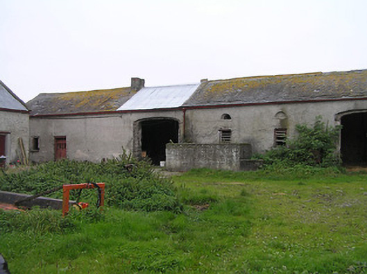 Bayswell Housefarmyard complex · 226 yd
 Crucifixion plaque in BayswellCrucifixion plaque · 284 yd
 Ladys WellHoly well · 298 yd
 Castle PierceHouse, fortified house · 1515 yd
 Church (in ruins)Church · 1526 yd
 IndicatedCastle, ringwork · 1.4 mi
 Cnoc SeanrathaMemorial · 2.0 mi
 DelaneyMemorial · 3.3 mi
 Tullow HillMountain / peak · 4.0 mi
 Street fieldArchaeological place · 4.5 mi
 Clonmeen WoodWood · 4.5 mi
 Clomantagh HillMountain / peak · 5.4 mi
Other information
Photo: Credit not shown in the picture search · Rights wording not checked; contact us if this picture should be removed