
What is recorded here
On the summit of a N-S ridge overlooking lower land to the E and W, in rolling pasture. The church is located in the NW angle of the graveyard, the graveyard wall running up to the N end of the E gable and the W end of the S wall. According to the OS Letters (1839) the church is known as 'Teampall na Ratha' or the church of the rath, probably in reference to the ringfort (KK008-142----) 30m N of the church (O'Flanagan 1930, vol. 1, 116-17 (39)). At time of inspection in 1987 the interior of the church was overgrown with trees and the walls were obscured by ivy. It is rectangular in plan (int. dims. 5.9m N-S; 14.2m E-W; ext. dims. 7.3m N-S; 15.6m E-W; wall T 0.7m), aligned E-W, built of roughly cut, coursed masonry. There is a window in the E gable and a niche, probably for a piscina, at the E end of the S wall. The OS Letters (ibid.) provide additional information describing, 'a broken doorway in the south side ten feet [c. 3m] from western gable; there is a window in each side at eight feet six inches [c. 2.6m] from east gable, three feet three inches [c. 1m] wide inside, broken at top and outside. There is a broken topped window in the east gable five feet [c. 1.5m] wide, ten feet [c. 3m] high to the springing of the arch inside; eight feet [c. 2.4m] high and nine inches [0.23m] wide on the outside. The arch has disappeared excepting the first stone'. Carrigan (1905, vol. 2, 300-302) mentions that the 'gables are fallen to a level with the side-walls' and that, 'Corbels for the support of a gallery project at the west end'. Associated with the church and graveyard (KK008-006002-) is a font (KK008-006003-), a graveslab (KK008-006004-) and a leacht (KK008-006-005-).
On the summit of a N-S ridge overlooking lower land to the E and W, in rolling pasture. The church is located in the NW angle of the graveyard, the graveyard wall running up to the N end of the E gable and the W end of the S wall. According to the OS Letters (1839) the church is known as 'Teampall na Ratha' or the church of the rath, probably in reference to the ringfort (KK008-142----) 30m N of the church…
From the National Monuments Service (Archaeological Survey of Ireland) record KK008-066001
The monument record does not grant public access. Check the route and ask the landowner before entering private land.
- What survives
- Recorded monument
Places near here
Photo credits
- A.-K. D., Wikimedia Commons · CC BY-SA 4.0
- kevin higgins, Geograph · CC BY-SA 2.0
- National Inventory of Architectural Heritage
- Mike Searle, Wikimedia Commons · CC BY-SA 2.0
- A.-K. D., Wikimedia Commons · CC0
- Sarah777 at en.wikipedia, Wikimedia Commons · Public domain
 Grave YardGraveyard · 12 yd
 Leacht in BayswellLeacht · 29 yd
 Saint Michael's Catholic ChurchChurch/chapel · 1565 yd
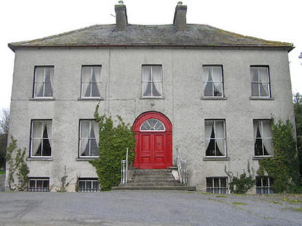 Bayswell HouseHouse · 1653 yd
_-_geograph.org.uk_-_4571595.jpg/250px-Castles_of_Leinster,_Castle_Pierce,_Kilkenny_(1)_-_geograph.org.uk_-_4571595.jpg "Photo: Mike Searle, Wikimedia Commons · CC BY-SA 2.0") Castle PierceHouse, fortified house · 1.6 mi
Castle PierceHouse, fortified house · 1.6 mi_-_geograph.org.uk_-_2495691.jpg/250px-Castles_of_Leinster,_Foulkscourt,_Kilkenny_(1)_-_geograph.org.uk_-_2495691.jpg "Photo: Mike Searle, Wikimedia Commons · CC BY-SA 2.0") Foulkscourt castle (in ruins)Castle, tower house · 1.7 miCnoc SeanrathaMemorial · 2.7 mi
Foulkscourt castle (in ruins)Castle, tower house · 1.7 miCnoc SeanrathaMemorial · 2.7 mi John HelyMemorial · 3.0 miTullow HillMountain / peak · 4.4 miStreet fieldArchaeological place · 4.7 mi
 Clomantagh HillMountain / peak · 5.0 miClonmeen WoodWood · 5.2 mi
More historic places in County Kilkenny · All of County Kilkenny
What do you know about this place?