What is recorded here
Thirty metres northeast of the Caherass saw mill race, a faint twenty-two-metre circle hid inside ordinary pasture, its centre hollow rather than its edge raised. Celie O’Rahilly saw a possible enclosure where others saw only grass, yet geophysical work and cutting opened just ridge-and-furrow cultivation, a narrow drain and no credible human remains. The Adare Bypass now covers that ambiguous dish, turning a brief archaeological doubt into a roadbed memory.
In pasture, 30m NE of a millrace associated with the saw mill at Caherass House, which lies 700m to NW and 100m NE of the River Maigue which also marks a townland boundary with Croom. Not depicted on OSI historic maps. Identified by Celie O’Rahilly, Limerick County Archaeologist as a possible enclosure which was described as: ‘A very faint trace of a circular area (approx. diam. 22m) which is defined more by a central hollow than a definite raised bank’. During a geophysical survey carried out in advance of the Adare Bypass, only traces of ridge-and-furrow cultivation and possible small iron objects were revealed. The presence of the cultivation features and a shallow, narrow drain were confirmed on further investigation (Licence No. 97E0405), however no diagnostic material was recovered from any of the cuttings. This site has been fully investigated and now lies under the route of the Adare Bypass, as can be seen on Google Earth orthoimages dated 28/06/2018.
See attached Google Earth orthoimage dated 28/06/2018
Compiled by: Alison McQueen and Vera Rahilly
Date of upload: 22 October 2020
The monument record does not grant public access. Check the route and ask the landowner before entering private land.
- What survives
- Recorded monument
Places near here
 Burnt spread in CroomBurnt spread · 325 yd
 Hachured (1924).Enclosure · 493 yd
 Church (in ruins)Church · 892 yd
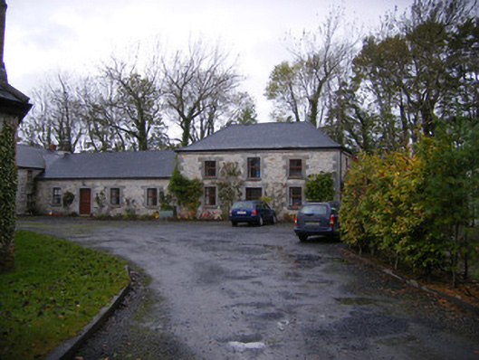 Caherass Houseoutbuilding · 911 yd
 Biodiversity in the Maigue CatchmentVisitor information · 1175 yd
 CastleCastle, Anglo-Norman masonry castle · 1483 yd
 Dysert AenghusaHeritage attraction · 1524 yd
 European ashEuropean ash · 1.4 mi
 Fanningstown Castle (in ruins)Castle, tower house · 1.4 mi
 Kinnoor WellSpring · 2.6 mi
 Monasteranenagh AbbeyHeritage attraction · 2.9 mi
 GinkgoGinkgo · 3.1 mi