What is recorded here
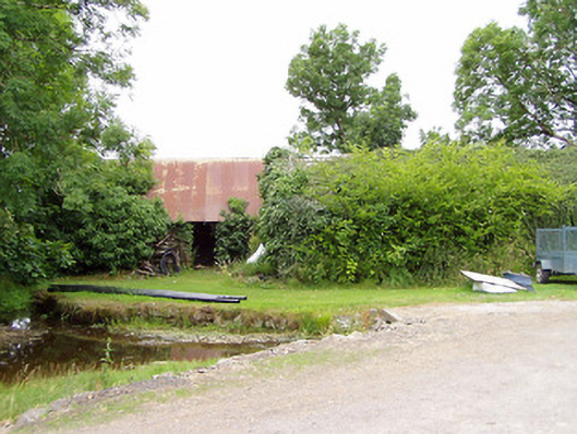
Killinlastra means a flaming wood, fitting a place where a fair house vanished without a trace. George Cunningham built it on a low rise overlooking the countryside, but a roadway and farmyard now occupy the site. The castle surrendered its stones to the living world, leaving only the name and the memory of fire in the wood.
On a low rise affording good views over the surrounding countryside. A castle-type building is indicated on an early 17th-century map of Ardagh barony (BL, Cotton MS Augustus I.ii.25). Named ‘Castle of Keillen’ on the OS Fair Plan. It may be the site of a house recorded by Nicholas Dowdall, in 1682, as ‘George Cunningham Esqr. Hath built a fair house at Killinlosorogh which signifies a flaming wood’ (Gillespie and Moran 1991, 210). The house has been levelled and no visible surface trace survives. The site is now partially occupied by a roadway and a farmyard.
Compiled by: Caimin O'Brien
Date of upload: 4 November 2012
The castle, known as the 'Castle of Keillen' on the Ordnance Survey, was likely built in the early 17th century, as indicated by its appearance on a map of Ardagh barony. Its strategic location on a low rise suggests it may have served a defensive or observational role in the region.
The monument record does not grant public access. Check the route and ask the landowner before entering private land.
- What survives
- Recorded monument
Places near here
 mill (water)mill (water) · 37 yd
 IndicatedChurch · 1016 yd
 LF014-104---- : Ringfort - rath : OLDTOWNArchaeological place · 1650 yd
 FortsFairy fort / earthen ringfort · 1669 yd
 Oldtown CopseWood · 1.3 mi
 Oldtown DemesneForest · 1.4 mi
 Bawn in LissardowlanBawn · 1.7 mi
 CastleCastle, Anglo-Norman masonry castle · 1.8 mi
 Saint Mel's CathedralCathedral · 3.8 mi
 First World War MemorialMemorial · 3.8 mi
 Graveyard in Curry (ardagh By., Coolamber Ed)Graveyard · 3.9 mi
 Granard MotteMotte-and-bailey castle remains · 11 mi