
What is recorded here
Indicated is a high, flat-topped bank with ditches on both sides, running between Carrickmines Castle and Kilgobbin castle on a valley floor at the foot of the Dublin Mountains. It may be part of the Pale Ditch, a boundary line drawn across living land. Thorns still grow on its crest, marking the place where permission ended and exclusion began.
Goodbody (1993) has identified an impressive section of linear earthwork, which may be part of the Pale Ditch. It is located on a valley floor at the foot of the Dublin Mountains. It runs on a line between Carrickmines Castle (DU026-005---) and Kilgobbin castle (DU025-017001-). It comprises a high, flat-topped bank (H 2.50m, Wth 2-3m) with contiguous ditches on both sides. The ditch on the northern side (Wth 2.4m, D 0.40m) is shallower than that on the southern side (Wth.3m, D 1m). There are thorns growing on the bank. Archaeological investigations in 1998 exposed a section through the base of the ditch (Wth 1.6m, D1.2m), no finds were recovered (Reid, M 1999, 61 https://www.excavations.ie/report/1998/Dublin/0003377/).
Compiled by: Geraldine Stout and Padraig Clancy.
Revised upload on: 21 April 2018.
The monument record does not grant public access. Check the route and ask the landowner before entering private land.
- What survives
- Recorded monument
Places near here
 Enclosure in Jamestown (rathdown By.)Enclosure · 196 yd
 Church in KilgobbinChurch · 735 yd
 Designed landscapeDesigned landscape, tree-ring · 1074 yd
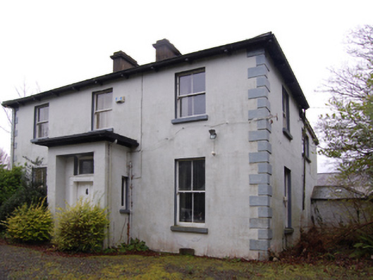 Clay Farmfarm house · 1115 yd
 Bawn in Carrickmines GreatBawn · 1251 yd
 Foxrock VillageVisitor information · 1567 yd
 Foxrock Village Heritage MapVisitor information · 1616 yd
 Murphystown Castle (in ruins)Castle, tower house · 1.1 mi
 Flat cemetery in CarmanhallFlat cemetery · 1.2 mi
 Silver BirchSilver Birch · 1.4 mi
 Monterey CypressMonterey Cypress · 1.4 mi
 Proclamation of the Irish RepublicMemorial · 1.6 mi
Other information
Photo: Credit not shown in the picture search · Rights wording not checked; contact us if this picture should be removed