What is recorded here
Fairy fort / ringfort in Ballynameagh is a fairy fort or ringfort in Ballynameagh, County Westmeath, Ireland. The site sits on a low natural rise of ground with good views to the north, east and southeast. A small circular enclosure was depicted on the 1837 edition Ordnance Survey 6-inch map and annotated as a fort on the 1837 Ordnance Survey Fair Plan map. The site was probably levelled between the 1837 and 1912 editions of the Ordnance Survey 6-inch maps, and no surface remains were visible.
Situated on a low natural rise of ground with good views to N, E and SE. No surface remains visible. Depicted as a small circular enclosure on 1837 ed. OS 6-inch map and annotated as 'Fort' on the 1837 OS Fair Plan map. Not depicted on revised editions of the OS 6-inch maps. Site probably levelled between 1837 and 1912 edition of the OS 6-inch maps.
Compiled by: Frank Coyne & Caimin O'Brien
Date of upload: 4 January 2017
The monument record does not grant public access. Check the route and ask the landowner before entering private land.
- What survives
- Recorded monument
Places near here
 IndicatedFairy fort / earthen ringfort · 410 yd
 Enclosure in Ballynagall LittleEnclosure · 744 yd
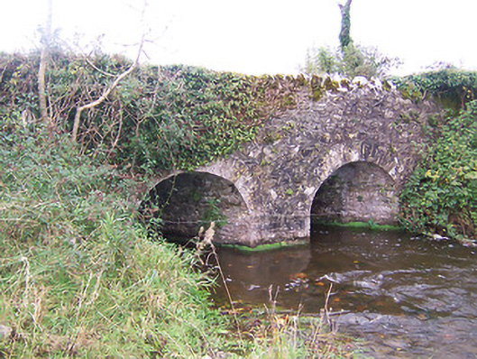 bridgebridge · 864 yd
 Ballynameagh Househouse · 1046 yd
 Turbotstown Ho.Castle, unclassified · 1.1 mi
 Rock of CurryCliff · 1.5 mi
 TowerCastle, tower house · 1.6 mi
 European ashEuropean ash · 1.6 mi
 Pedunculate OakPedunculate Oak · 1.8 mi
 Mullaghmeen ForestPicnic place · 3.7 mi
 Mullaghmeen Red WalkWalking route · 3.8 mi
 Mullaghmeen White WalkWalking route · 3.8 mi