What is recorded here
Fairy fort / earthen ringfort in Balgree stands on a NE-facing slope in County Meath, Ireland. Its circular grass-covered area measures about 38m N-S and 37m E-W, bounded by a slight scarp reaching 1.3m high and 2.8m wide at the north. The 1836 OS 6-inch map marked it as a Fort, while the 1912 edition drew an arc across its NW-E side. People may have lived, hidden or gathered within that shallow ring before the land smoothed its edges into grass.
Located towards the bottom of a NE-facing slope. A circular embanked enclosure (ext. diam. c. 40m) is represented on the 1836 edition of the OS 6-inch map where it is described as a ‘Fort’, and an arc of hachures is represented on the 1912 edition NW-E (Chord c. 40m). This is a circular grass-covered area (diam. c. 38m N-S; c. 37m E-W) defined by a slight scarp (max. dims at N: Wth 2.8m; H 1.3m).
The above description is derived from the published 'Archaeological Inventory of County Meath' (Dublin: Stationery Office, 1987). In certain instances the entries have been revised and updated in the light of recent research.
Compiled by: Michael Moore
Date of revision: 22 February 2019
The monument record does not grant public access. Check the route and ask the landowner before entering private land.
- What survives
- Recorded monument
Places near here
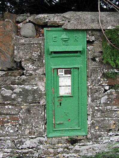 post boxpost box · 635 yd
 bridgebridge · 693 yd
 IndicatedEnclosure · 876 yd
 EnclosureEnclosure, large enclosure · 979 yd
 Balgree MoteCastle, motte · 988 yd
 Ballyhist WoodWood · 1279 yd
 FortsCastle, motte and bailey · 1293 yd
 Woodpole Fox CovertWood · 1.4 mi
 Oliver Plunkett memorialMemorial · 3.1 mi
 IslandboyIslet · 3.2 mi
 Stony IslandIslet · 3.4 mi
 MaperathMountain / peak · 3.5 mi