What is recorded here
In pasture, on top of a drumlin. An arc formed by a scarp NE-SSE and by an earthen bank (Wth 4.5m; int. H 0.7m) with an external fosse (Wth 4.2m; D 0.1m) SSE-SW encloses an area (dims. 25.3m N-S; 33m E-W) at the NW corner of a field (Pl. 36). This appears to be remains of a rath which has been truncated by the field boundaries at N and NW. There are no visible remains of the rath in the field to the N. A conjoined rath (SL038-119001-) lies on the opposite side of the field boundary at NW.
The above description is derived from the published 'Archaeological Inventory of County Sligo' compiled by Ursula Egan, Elizabeth Byrne, Mary Sleeman with Sheila Ronan and Connie Murphy (Dublin Stationery Office, 2005).
Date of upload: 18 January 2008
Aughris Fort, Kilturra is a ringfort, likely dating to the early medieval period, characterized by a scarp, earthen bank, and fosse enclosing an oval area. Local tradition may associate such sites with fairy folklore, though specific legends connected to this fort are not recorded.
This remains an important historical record, but the official description says the monument is no longer visible or has been destroyed. The monument record does not grant public access. Check the route and ask the landowner before entering private land.
- What survives
- No visible remains or recorded as destroyed
Places near here
 Aughris FortFairy fort / earthen ringfort · 41 yd
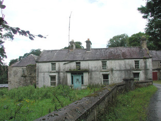 Knockalass Housefarm house · 740 yd
 Kilturra church (in Ruins)Church · 784 yd
 Enclosure in Knockrawer (corran By., Kilturra Ed)Enclosure · 859 yd
 Ballyfahy Castle (in Ruins)Castle, unclassified · 1.4 mi
 Castle (in Ruins)Castle, tower house · 1.7 mi
 Tymon's HillMountain / peak · 1.7 mi
 Old Cave Burial GroundArchaeological place · 4.6 mi
 Muckelty HillMountain / peak · 5.1 mi
 Brother WalfridMemorial · 5.2 mi
 Caves of KeshCave · 6.4 mi
 School CaveCave · 7.3 mi