
What is recorded here
Man-made underground passage in Adamstown (moycashel By.) is a man-made underground passage in Adamstown (moycashel By.), County Westmeath, Ireland. Situated on a low rise in wet and marshy pasture, it was described in 1978 as a small opening on the south side of a mound or possible ringfort. The entrance, measuring 0.7 metres wide and 0.3 metres deep, lay under a flat slab with a roof that sloped downwards into a drystone passage approximately 2 metres deep. This passage appears to have been blocked by collapse, and the monument was backfilled by 1981, leaving a depression with a large scatter of stones that may have belonged to a nearby limekiln.
Situated on a low rise, in wet and marshy pasture. Monument described in 1978 as located in the S side of a mound or possible ringfort (WM025-134001-) is a small opening (dims. Wth 0.7m; D 0.3m) located under a flat slab. The roof slopes downwards and a depth of approximately 2m is detected. This leads into a drystone passage which appears to be blocked by collapse. Monument appears to have been backfilled by 1981 when it is described as a depression with a large scatter of stones. There is a limekiln marked near this location on the 1838 ed. OS 6-inch map and it is possible that the stones mentioned above belonged to this structure but this is uncertain.
Compiled by Alison McQueen, Vera Rahilly and Caimin O’Brien.
Date of upload: 24 September 2019
The monument record does not grant public access. Check the route and ask the landowner before entering private land.
- What survives
- Recorded monument
Places near here
 Adamstown Castle (in Ruins)Castle, tower house · 126 yd
 bridgebridge · 847 yd
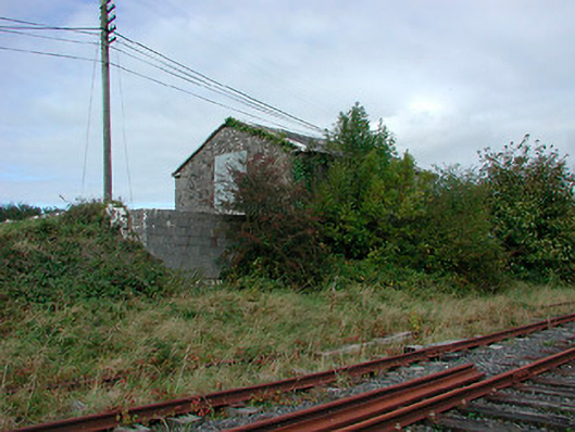 Castletown Railway Stationstore/warehouse · 863 yd
 Ecclesiastical enclosure in Adamstown (moycashel By.)Ecclesiastical enclosure · 907 yd
 Dotted outlineFairy fort / earthen ringfort · 1021 yd
 Rathdrishoge CastleCastle, unclassified · 1135 yd
 Hill of UisneachMountain / peak · 3.2 mi
 European ashEuropean ash · 3.6 mi
 Sam's ParkForest · 3.6 mi
 KnockastiaMountain / peak · 5.1 mi
 St. Columba's WellSpring · 8.8 mi
 Moate HillMountain / peak · 9.6 mi
Other information
Photo: Credit not shown in the picture search · Rights wording not checked; contact us if this picture should be removed