What is recorded here
Marked as a circular embanked enclosure (ext. diam. c. 60m) on the 1839 and 1925 eds of the OS 6 inch maps and named as ‘Rathavally’ in gothic script on both, but removed since 1925. It is situated at the W edge of a plateau and is visible as a slightly sunken circular area on the ground in a cereal crop. It is visible as a cropmark enclosure (diam. c. 40m) on aerial photographs (MM (18) 7-10).
From the National Monuments Service (Archaeological Survey of Ireland) record WX040-019
The monument record does not grant public access. Check the route and ask the landowner before entering private land.
- What survives
- Recorded monument
Places near here
Photo credits
- National Inventory of Architectural Heritage
- Mike Searle, Wikimedia Commons · CC BY-SA 2.0
- Mike Searle, Geograph · CC BY-SA 2.0
- Richard Webb, Geograph · CC BY-SA 2.0
Embanked enclosureFairy fort / earthen ringfort · 726 ydLadys WellHoly well · 1068 yd Yoletown MillMill (water) · 1264 ydMullinderry BridgeBridge · 1662 ydRathumney Castle (in ruins)Castle, hall-house · 2.9 miLockheed Hudson am885 MemorialMemorial · 3.2 miCoolcliffe HouseRuins · 3.2 miBlack Castle (in ruins)Castle, tower house · 3.7 miCarrickbyrne HillMountain / peak · 4.4 miTinnock RockNamed rock · 5.0 mi1798Memorial · 5.1 miTintern AbbeyStables · 5.1 mi
 Yoletown MillMill (water) · 1264 yd
 Mullinderry BridgeBridge · 1662 yd
 Rathumney Castle (in ruins)Castle, hall-house · 2.9 miLockheed Hudson am885 MemorialMemorial · 3.2 miCoolcliffe HouseRuins · 3.2 mi
 Black Castle (in ruins)Castle, tower house · 3.7 mi
 Carrickbyrne HillMountain / peak · 4.4 miTinnock RockNamed rock · 5.0 mi1798Memorial · 5.1 mi
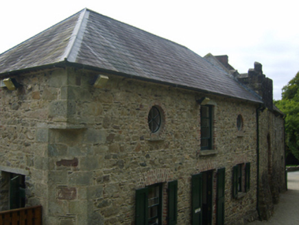 Tintern AbbeyStables · 5.1 mi
More archaeology and monuments in County Wexford · All of County Wexford
What do you know about this place?