What is recorded here
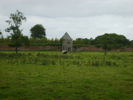
Marked on the 1839 and the 1925 eds of the OS 6-inch map and described as Lady’s Well in gothic lettering on both, with the addition of 'Site of' on the later map. John O’Donovan writing c. 1840 says it was then concealed in shrubbery (O’Flanagan 1933, vol. 2, 357). It is situated in a fold on a gentle W-facing slope in the valley of the N-S Owenduff River, with the stream c. 70m to the W. It is not visible in reclaimed pasture.
Marked on the 1839 and the 1925 eds of the OS 6-inch map and described as Lady’s Well in gothic lettering on both, with the addition of 'Site of' on the later map. John O’Donovan writing c. 1840 says it was then concealed in shrubbery (O’Flanagan 1933, vol. 2, 357). It is situated in a fold on a gentle W-facing slope in the valley of the N-S Owenduff River, with the stream c. 70m to the W. It is not visible in…
From the National Monuments Service (Archaeological Survey of Ireland) record WX040-018
The monument record does not grant public access. Check the route and ask the landowner before entering private land.
- What survives
- Recorded monument
Places near here
Photo credits
- National Inventory of Architectural Heritage
- Mike Searle, Wikimedia Commons · CC BY-SA 2.0
- Richard Webb, Geograph · CC BY-SA 2.0
- David Purchase, Wikimedia Commons · CC BY-SA 2.0
- Colin Park, Geograph · CC BY-SA 2.0
- Julie Anne Workman, Wikimedia Commons · CC BY-SA 3.0
IndicatedStructure · 588 ydEmbanked enclosureFairy fort / earthen ringfort · 797 yd Abbey VilleBuilding misc · 906 ydYoletown MillMill (water) · 1224 ydRathumney Castle (in ruins)Castle, hall-house · 2.4 miLockheed Hudson am885 MemorialMemorial · 3.1 miCastle (in ruins)Castle, tower house · 3.6 miCoolcliffe HouseRuins · 3.8 miCarrickbyrne HillMountain / peak · 4.5 miSlievecoiltiaMountain / peak · 5.1 miCampile WWII Bombing MemorialMemorial · 5.2 miCommon Whitebeam6.6 mi
 Abbey VilleBuilding misc · 906 yd
 Yoletown MillMill (water) · 1224 yd
 Rathumney Castle (in ruins)Castle, hall-house · 2.4 miLockheed Hudson am885 MemorialMemorial · 3.1 mi
_-_geograph.org.uk_-_7608906.jpg/250px-Castles_of_Leinster,_Tellarought,_Wexford_(1)_-_geograph.org.uk_-_7608906.jpg "Photo: Mike Searle, Wikimedia Commons · CC BY-SA 2.0") Castle (in ruins)Castle, tower house · 3.6 miCoolcliffe HouseRuins · 3.8 mi
Castle (in ruins)Castle, tower house · 3.6 miCoolcliffe HouseRuins · 3.8 mi Carrickbyrne HillMountain / peak · 4.5 mi
 SlievecoiltiaMountain / peak · 5.1 mi
 Campile WWII Bombing MemorialMemorial · 5.2 mi
 Common Whitebeam6.6 mi
More archaeology and monuments in County Wexford · All of County Wexford
What do you know about this place?