
What is recorded here
On crest of broad, flat-topped hill, above 400ft contour. Land falling gently W of monument, in pastureland. Hedgerow running N-S 4m E of moated site and field boundary running E-W 5m S of it. Though not in a typical moated site location, it consists of a rectangular area (diam. 30.3m N--S; 34.5m E-W) defined by low,…
Read the whole record
From the National Monuments Service (Archaeological Survey of Ireland) record TS076-013
Places near here
Photo credits
- National Inventory of Architectural Heritage
- Maker not stated on source page, en.wikipedia.org
- Maker not stated on source page, commons.wikimedia.org
- Maker not stated on source page, tr.pinterest.com
- Maker not stated on source page, www.alamy.com
- Benutzer:StefanServos, Wikimedia Commons · CC BY-SA 3.0
- Algirdas at Lithuanian Wikipedia, Wikimedia Commons · Public domain
- Maker not stated on source page, www.irishmirror.ie
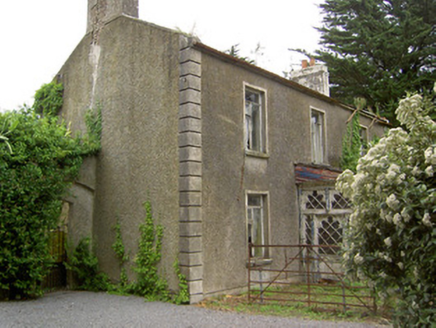 Shanballyard HouseHouse · 1093 yd
Explorer Tom Shanballyard House is modest in size but surrounded by farm buildings that are still working hard today. It has a…
 Church in DecoyChurch · 1437 yd
Explorer Tom Church in Decoy is known as Mocuana’s Church, which sounds like a name invented by someone who’d had three pints too…
 Westgrove HouseHouse · 1603 yd
Explorer Tom Westgrove House in Donegal is whispering tales about a hidden tunnel that leads straight to the pub down the road. The…
 Earthwork in Caddlestown,springfield (knockgraffon Par.)Earthwork · 1727 yd
Explorer Tom Caddlestown has an earthwork that bragged about surviving storms but mostly just survived being forgotten by the…
 Ballinattin HouseHouse · 1.3 mi
Explorer Tom Ballinattin House in Ballinattin Upper has had so many former names it’s lost its own identity completely. It’s a…
 Castle (in ruins)Castle, unclassified · 1.5 mi
Explorer Tom Castle in Maginstown is built on a rise of collapsed masonry, which means it’s basically a pile of rocks with ambition.…
 Fairy fort / earthen ringfort in RathardFairy fort / earthen ringfort · 1.8 mi
Explorer Tom Fairy fort / earthen ringfort in Rathard smells like wet dirt, old nettles, and the faint ghost of a bad decision from…
 Old Ballyclerihan GraveyardGraveyard · 1.9 mi
Explorer Tom Old Ballyclerihan Graveyard in County Tipperary is stuck in a feud with its neighbour over who owns the sunset view.…
 Site of Black CastleArchaeological place · 1.9 mi
Explorer Tom Site of Black Castle has a family tree so convoluted it looks like a game of Twister played with historical figures and…
 Cahir CastleCastle · 5.3 mi
Explorer Tom Cahir Castle's first owner planned to escape via a moat that was mostly just wet mud. It’s the ultimate 'I meant to do…
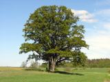 Pedunculate Oak6.2 mi
Explorer Tom Pedunculate Oak in County Tipperary was planted by a builder who was really thinking about lunch rather than the soil…
 Graveyard in Kilcommon More (north)Graveyard · 6.3 mi
Explorer Tom Graveyard in Kilcommon More was lost because a priest bet his church to a Swiss cottage owner, who then paved over the…
More archaeology and monuments in County Tipperary · All of County Tipperary

What do you know about this place?Tap to add a comment or ask a question