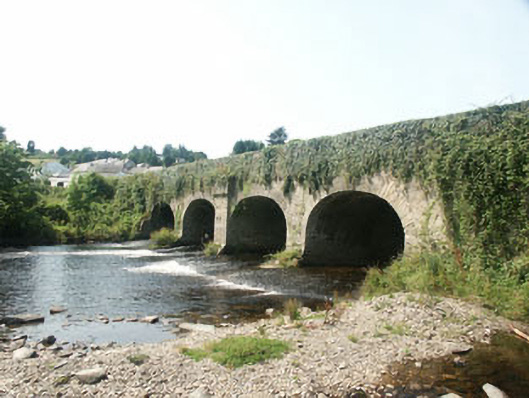
What is recorded here
Five-arch road bridge over the Avonmore River, built c.1780, but probably widened in the mid 19th century. The bridge is constructed in rubble but largely covered in ivy growth to the south side. Four of the arches are evenly spaced with that to the east end, a ‘flood arch’ is set further apart. The south side is markedly different than the north, with the arches to the south elliptical with rough voussoirs and plain piers, whilst those to the north are segmental with dressed voussoirs and piers with rounded breakwater, all suggesting the bridge has been widened to the north side. The central pier to the south side has a corbelled projection above arch level.
This still impressive 18th to 19th-century road bridge, which, along with the large and equally impressive neighbouring former corn mill, forms a visually interesting rubble-built mass on the northern approach to Rathdrum.
From the Buildings of Ireland (National Inventory of Architectural Heritage) record 16318042
This does not grant access. Most recorded buildings are privately owned; view them only from public ground unless the owner allows entry.
Places near here
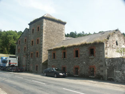 Rathdrum MillsMill (water) · 51 yd
 post box192 ydIndicatedFairy fort / earthen ringfort · 509 ydParnell MonumentMemorial · 866 ydEnclosure in Glasnarget NorthEnclosure · 913 ydWicklow 400Memorial · 931 ydCastle in ruinsCastle, tower house · 1.1 mi
 Noble Fir1.6 mi
 European Yew1.6 mi
 Viewing TowerHeritage attraction · 1.7 mi
 Carrick MountainMountain / peak · 4.1 mi
 Poulanass WaterfallWaterfall · 6.7 mi
Pictures: National Inventory of Architectural Heritage; Walter Siegmund (talk), Wikimedia Commons · CC BY-SA 3.0; Sitomon, Wikimedia Commons · CC BY-SA 2.0; 瑞丽江的河水, Wikimedia Commons · CC BY-SA 4.0; Sarah777 at English Wikipedia, Wikimedia Commons · Public domain; 1ivia, Wikimedia Commons · CC BY 2.0
More historic places in County Wicklow · All of County Wicklow
What do you know about this place?