What is recorded here
Situated on level to gently sloping S-facing ground in gently undulating terrain. Circular area (diam. 43.5m) defined from SW to ENE by an earthen bank (Wth 4.7-6.6m; int. H 0.9-1.2m; ext. H 1.9-2.5m) with an external fosse best preserved at the NW (Wth 3.5m; D 0.6m); no trace of bank or fosse E-SW. No indication of an entrance or internal features.
From the National Monuments Service (Archaeological Survey of Ireland) record WI030-010
The monument record does not grant public access. Check the route and ask the landowner before entering private land.
- What survives
- Recorded monument
Places near here
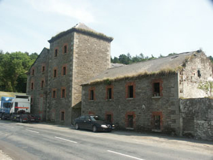 Rathdrum MillsMill (water) · 472 yd
 bridge502 ydEnclosure in Glasnarget NorthEnclosure · 841 ydParnell MonumentMemorial · 941 ydWicklow 400Memorial · 1004 ydIndicatedFairy fort / earthen ringfort · 1075 ydCastle in ruinsCastle, tower house · 1.2 mi
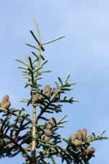 Noble Fir1.4 mi
 European Yew1.5 mi
 Viewing TowerHeritage attraction · 1.6 miBallinastrawMountain / peak · 2.0 mi
 Carrick MountainMountain / peak · 4.1 mi
Pictures: National Inventory of Architectural Heritage; Walter Siegmund (talk), Wikimedia Commons · CC BY-SA 3.0; Sitomon, Wikimedia Commons · CC BY-SA 2.0; 瑞丽江的河水, Wikimedia Commons · CC BY-SA 4.0; Sarah777 at English Wikipedia, Wikimedia Commons · Public domain
More archaeology and monuments in County Wicklow · All of County Wicklow
What do you know about this place?