What is recorded here
On ground sloping gradually to NE in gently undulating terrain, under pasture. Interior grass covered and appears to be somewhat waterlogged in places with small area of reeds. Large enclosure (diam. 74m N-S; 80m E-W) defined by bank (Wth 3.2-2.1m crest, 3.4-4m base; H above int. 0.52-0.87m; H above fosse 1.7-1.85m)…
Read the whole record
From the National Monuments Service (Archaeological Survey of Ireland) record TS076-041
Places near here
Photo credits
- National Inventory of Architectural Heritage
- Algirdas at Lithuanian Wikipedia, Wikimedia Commons · Public domain
- Mike Searle, Wikimedia Commons · CC BY-SA 2.0
- Mike Searle, Geograph · CC BY-SA 2.0
- Paul Evans from London, United Kingdom, Wikimedia Commons · CC BY 2.0
- A.-K. D., Wikimedia Commons · CC BY-SA 4.0
- Colin Park, Geograph · CC BY-SA 2.0
- A.-K. D., Wikimedia Commons · CC0
- Digital Eye, Wikimedia Commons · CC BY-SA 4.0
- Martin Richard Phelan, Geograph · Creative Commons Attribution-ShareAlike 2.0
 The Old RectoryRectory/glebe/vicarage/curate's house · 1069 yd
 Westgrove HouseHouse · 1.4 mi
 Pedunculate Oak1.5 mi
 Moorstown CastleCastle · 2.2 mi
 Nicholastown Castle (in ruins)Castle, tower house · 3.5 mi
Explorer Tom Nicholastown Castle claims to be older than the concept of Tuesday. It sits on that limestone ledge like it’s judging your life choices. Bring a friend who talks too much and let the place shut them up.
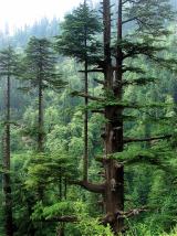 Deodar Cedar4.4 mi
 Merchant's HouseVisitor information · 4.5 mi
 Streches IslandIsland · 4.5 mi
 Charles BianconiMemorial · 4.5 mi
 Main GuardHeritage attraction · 4.5 mi
 Grave YardGraveyard · 6.0 mi
Explorer Tom Graveyard in Fethard had a fiddler who played there all night until the stones started dancing. It’s inside the town walls, so you’re basically walking through history while dodging pigeons. Bring wellies and low expectations, leave delighted.
 Sheela-na-gig in FethardSheela-na-gig · 6.0 mi
More archaeology and monuments in County Tipperary · All of County Tipperary

What do you know about this place?Tap to add a comment or ask a question