
What is recorded here
From the Northern Ireland Sites and Monuments Record record FER261:003
Places near here
Photo credits
- Maker not stated on source page, www.pinterest.com
- Maker not stated on source page, ca.pinterest.com
- Maker not stated on source page, commons.wikimedia.org
- Maker not stated on source page, ru.pinterest.com
- Maker not stated on source page, www.ireland.com
- Eric Jones, Wikimedia Commons · CC BY-SA 2.0
- Maker not stated on source page, www.flickr.com
- Maker not stated on source page, tr.pinterest.com
- National Inventory of Architectural Heritage
- Kenneth Allen, Geograph · CC BY-SA 2.0
- Iacobndg, Wikimedia Commons
 Castle: lord highgate's castle in Agharoosky EastCastle: Lord Highgate's Castle · 694 yd
Explorer Tom Lord Highgate's Castle in Agharoosky East is definitely haunted by a giant who forgot how to fold his laundry. The…
 Church & Graveyard: Magheraveely in UttonyChurch & Graveyard: Magheraveely · 1.4 mi
Explorer Tom Church & Graveyard: Magheraveely in Uttony thinks Dublin tourists smell like overpriced coffee and bad decisions. It’s…
 Magheraveely (Uttony) GraveyardCemetery · 1.4 mi
Explorer Tom "Magheraveely (Uttony) Graveyard has been having a massive drama with the nearest tree, arguing about whose shadow is…
 Island, possibly crannog in Rossbrick GlebeIsland, possibly crannog · 1.5 mi
Explorer Tom Rossbrick Glebe’s possible crannog island has a long-standing grudge with the weather for being so unpredictable. It’s…
 Mapped cemeteryCemetery · 1.9 mi
Explorer Tom "Mapped cemetery ended up in the wrong place because a cartographer got drunk on whiskey and drew the boundary line…
 Castle in AghagayCastle · 2.1 mi
Explorer Tom Castle in Aghagay has an uncertain record, so it’s basically a mystery box of masonry. No dates, no drama, just vibes.…
 Battle of NewtownbutlerBattle · 2.1 mi
Explorer Tom Battle of Newtownbutler got the map makers so confused they ended up putting the town on the wrong side of the river…
 Island, possibly crannog in LisleaIsland, possibly crannog · 2.3 mi
Explorer Tom Island, Possibly Crannog in Lislea is proud of being 'possibly' a crannog, which is a great way to avoid…
 Penitential station stones (associated with Fer 0272:003, Holy Well) in KiltoberPenitential station stones (associated with Fer 0272:003, Holy Well) · 3.7 mi
Explorer Tom Penitential station stones in Kiltober are associated with a holy well that probably smells like wet socks and regret…
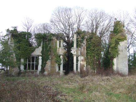 Lanesborough LodgeCountry house · 4.9 mi
Explorer Tom Lanesborough Lodge in Quivvy used to be a big deal before a fire ate it up in the 1920s. Now it’s just ruins pretending…
 Estate Trail, CromWalking route · 5.4 mi
Explorer Tom Estate Trail, Crom is playing hard to get, dodging nosey neighbours like they’re dodging a bill. It’s got that 'I’m too…
 Crom Estate (National Trust)Park · 5.4 mi
Explorer Tom Crom Estate has two castles, and one of them would prefer you kept your distance. The public grounds stretch over about…
More archaeology and monuments in County Fermanagh · All of County Fermanagh

What do you know about this place?Tap to add a comment or ask a question