
What is recorded here
From the National Monuments Service (Archaeological Survey of Ireland) record DG010-022
Places near here
Photo credits
- Andreas F. Borchert, Wikimedia Commons · CC BY-SA 4.0
- N Chadwick, Wikimedia Commons · CC BY-SA 2.0
- David Ayrton, Geograph · CC BY-SA 2.0
- National Inventory of Architectural Heritage
- Maker not stated on source page, www.dailykos.com
- Maker not stated on source page, www.flickr.com
- N Chadwick, Geograph · CC BY-SA 2.0
- Kenneth Allen, Geograph · CC BY-SA 2.0
- Andreas F. Borchert, Wikimedia Commons · CC BY-SA 3.0 de
- Michael Dibb, Geograph · CC BY-SA 2.0
- Maker not stated on source page, www.tuatha.ie
 Raghtin MoreMountain / peak · 41 yd
Explorer Tom Raghtin More stands over western Inishowen like a rather proud lookout who has borrowed every bay on the horizon for…
 Glenevin WaterfallWaterfall · 1.0 mi
Explorer Tom Glenevin Waterfall waits up a green valley near Clonmany, where a stream crosses the path again and again before…
 Glenevin Waterfall, ClonmanyWaterfall · 1.0 mi
Explorer Tom Glenevin Waterfall near Clonmany has the courtesy to let you hear its stream and walk beside it before showing you the…
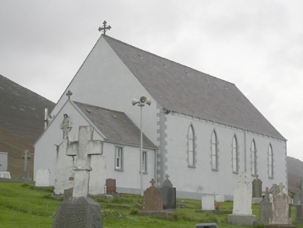 St. Michael’s Catholic ChurchChurch/chapel · 1.0 mi
Explorer Tom St. Michael’s Catholic Church in Letter leans back so far its eaves are practically scratching the sky for balance. The…
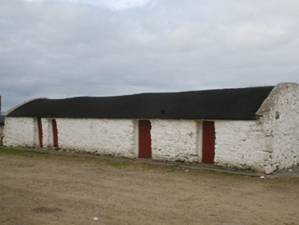 outbuilding1.3 mi
Explorer Tom The account for Outbuilding in Urrismenagh describes four stone buildings around three sides of a yard, under…
 Bullaun stone in Straid (straid Ed)Bullaun stone · 1.4 mi
Explorer Tom Bullaun stone in Straid is hiding its secrets because there’s no description yet! I wonder if it’s a pock-marked rock…
 Standing stone in Straid (straid Ed)Standing stone · 1.4 mi
Explorer Tom Standing stone in Straid is a shiny quartz block that only moved a tiny bit! I imagine it slipped on some wet grass and…
 Glenevin Waterfall WalkOfficial walking route · 1.5 mi
Explorer Tom Glenevin Waterfall Walk in County Donegal is basically a stream that has been told it’s a waterfall so many times it’s…
 Rusty NailPub · 1.5 mi
Explorer Tom Rusty Nail pub in County Donegal is held together by hope and one very stubborn, rusty nail that has its own…
 Mamore HillMountain / peak · 1.5 mi
Explorer Tom Right then, we've got ourselves a proper mountain called Mamore Hill tucked away in County Donegal. I imagine it's the…
 Gap of Mamore ViewpointViewpoint · 1.6 mi
Explorer Tom Mamore Gap has a splendid trick: it makes you work for the view, then hands you half of Inishowen at once. The road…
 CastleCastle, unclassified · 1.7 mi
Explorer Tom A castle stood beside the church at Straid in 1600, perhaps a stone house occupied by a priest named Amerson. Its exact…
More archaeology and monuments in County Donegal · All of County Donegal

What do you know about this place?Tap to add a comment or ask a question