What is recorded here
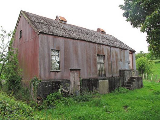
Detached three-bay former creamery, built c.1900. Pitched corrugated asbestos roof, with cast-iron ridge tiles, round-plan sheet metal chimney, pitched louvered metal roof-vents, and with decorative timber bargeboards to gables. Corrugated-iron cladding to walls, on cement rendered plinth base. Square-headed window openings, having timber surrounds and fittings, render sill to west elevation. Square-headed vent opening to apex of north elevation, with timber fittings. Square-headed former openings to east elevation with render sills, now boarded up. Square-headed door openings to east elevation, having corrugated-iron sliding door, opening onto rendered loading platform. Square-headed door opening to ground level of west elevation and to top of loading platform, with timber battened doors. Square-headed door opening at ground level to south elevation with double-leaf timber battened door. Some machinery to interior.
This former creamery is a notable example of twentieth-century rural industry. It serves as a reminder of the socioeconomic history of this locality, prior to large-scale mechanisation of dairy agriculture and centralisation of milk processing facilities throughout the country. Local creameries had both an economic function, as part of the milk production industry, and a social function as a meeting place for farmers and commercial agents. Constructed predominantly of corrugated-iron, it retains a number of salient features such as raised doors on to platforms, which were used as loading bays for creamery cans from carts. The building also sports original vents, and some machinery to the interior. Such structures are becoming increasingly rare and this creamery makes an important and striking contribution to the architectural and agricultural heritage of the area.
This does not grant access. Most recorded buildings are privately owned; view them only from public ground unless the owner allows entry.
Places near here
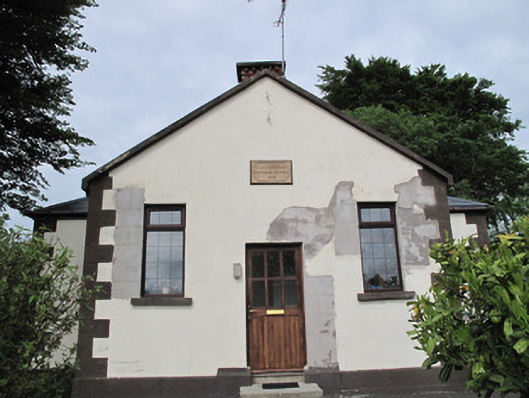 Radeerpark National Schoolschool · 246 yd
 Radeerpark fortFairy fort / earthen ringfort · 680 yd
 Caldragh fortEnclosure, large enclosure · 801 yd
 Old Church (in Ruins)Church · 1533 yd
 European YewEuropean Yew · 1.5 mi
 Common LimeCommon Lime · 1.7 mi
 Saint John's WellSpring · 1.9 mi
 Abbey RuinsHeritage attraction · 2.5 mi
 The Cassandra Hand CentreMuseum · 2.5 mi
 Bawn in CrossmoyleBawn · 2.5 mi
 CastleCastle, motte and bailey · 2.6 mi
 Tomb HillMountain / peak · 3.4 mi
Other information
Photo: National Inventory of Architectural Heritage · Website use allowed for educational or private purposes with source credit