What is recorded here
Situated on the E-facing slope of a hillock, which is on an E-W ridge. During the Middle Ages Galloon was a large parish, which was only broken up in 1806 (Shirley 1879, 327) when the parishes of Killeevan, Aghabog, Currin, and Ematris, also known as Edergole, were established in Co. Monaghan by the Church of Ireland.…
Read the whole record
From the National Monuments Service (Archaeological Survey of Ireland) record MO018-044001
Places near here
Photo credits
- Maker not stated on source page, ru.pinterest.com
- National Inventory of Architectural Heritage
- Anthony Foster, Geograph · Creative Commons Attribution-ShareAlike 2.0
- Maker not stated on source page, www.undiscoveredscotland.co.uk
- Maker not stated on source page, www.pinterest.com
- This file is from the Mechanical Curator collection , a set of over 1 million images scanned from out-of-copyright books and released to Flickr Commons by the British Library. View image on Flickr View all images from book View catalogue entry for book ., Wikimedia Commons · Public domain
- Maker not stated on source page, ca.pinterest.com
- D Gore, Geograph · CC BY-SA 2.0
 Edergole GraveyardGraveyard · 22 yd
Explorer Tom Edergole Graveyard in Monaghan is home to a local legend about a giant who moved there because he found the noise level…
 Holy Trinity Catholic ChurchChurch/chapel · 1647 yd
Explorer Tom Holy Trinity Catholic Church is suspicious of the postman because he never brings good news, only bills. It’s got…
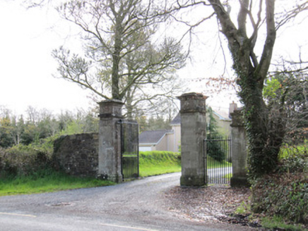 Dartrey HouseGates/railings/walls · 1.1 mi
Explorer Tom Dartrey House entrance is a masterpiece of demesne architecture with cut and carved stone piers that demand your full…
 Dawson MonumentMonument · 1.2 mi
Explorer Tom Dawson Monument is watching a poet fall in the ditch nearby and pretending it didn’t see anything to save face. It’s…
 Standing stone in DrummullaStanding stone · 1.2 mi
Explorer Tom Standing stone in Drummulla refuses to fall down because it’s waiting for someone to pay its parking fine from 1840.…
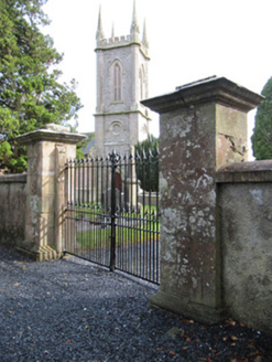 Church of Saint John the Evangelist (Ematris)Gates/railings/walls · 1.3 mi
Explorer Tom Church of Saint John the Evangelist (Ematris) would complain to the council about all that modern signage cluttering…
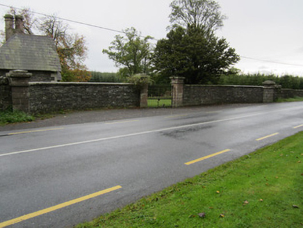 Fair FieldGates/railings/walls · 1.3 mi
Explorer Tom Fair Field has very strong opinions on modern buildings, calling them 'lame' and 'too flat'. It survived while the big…
 Fairy fort / earthen ringfort in KinduffFairy fort / earthen ringfort · 1.4 mi
Explorer Tom Fairy fort / earthen ringfort in Kinduff has a local superstition that says you must whistle or it gets offended. It’s…
 Dartrey ForestForest · 1.8 mi
Explorer Tom Dartrey Forest used to have a great house at its centre, and the trees have done a fine job of carrying on without it.…
 CastleCastle, unclassified · 1.8 mi
Explorer Tom Castle in Dawson Grove Demesne is a McMahon Castle according to local legend, but it’s so unconfirmed that even the…
 Mapped graveyardGraveyard · 1.8 mi
Explorer Tom this Mapped graveyard in County Monaghan has a ghost that’s too lazy to haunt it because he prefers to nap in the warm…
 Flagpole HillMountain / peak · 2.0 mi
Explorer Tom Flagpole Hill is the sort of peak that clearly had a mother-in-law design it, giving it that distinct look of…
More historic places in County Monaghan · All of County Monaghan

What do you know about this place?Tap to add a comment or ask a question