
Places near here
Photo credits
- Dieglop, Wikimedia Commons · CC BY-SA 4.0
- Tjp finn, Wikimedia Commons · CC BY-SA 4.0
- National Inventory of Architectural Heritage
- Mike Searle, Wikimedia Commons · CC BY-SA 2.0
- EecherplazGinkgo06.jpg : Cayambe derivative work: Ginkgotree ( talk ), Wikimedia Commons · CC BY-SA 3.0
- Olivier BEZES, Wikimedia Commons · CC BY 2.5
- jai, Wikimedia Commons · CC BY-SA 2.0
- John M, Geograph · CC BY-SA 2.0
- Sitomon, Wikimedia Commons · Public domain
- David Brossard, Wikimedia Commons · CC BY-SA 2.0
- Martin Richard Phelan, Wikimedia Commons · CC BY-SA 2.0
 MonasteryEcclesiastical residence · 1.3 mi
 Monastic RuinsChurch · 1.4 mi
 Saint Patrick's Fire: Hill of SlaneLegend location · 1.4 mi
Explorer Tom Saint Patrick's Fire: Hill of Slane has Patrick lighting his Easter flame before the king's fire on Tara. No wonder the story says Laoghaire was furious. I love a grand entrance, but I might have sent a note first.
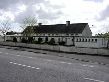 Saint Patrick's National SchoolSchool · 1.7 mi
Explorer Tom Saint Patrick’s National School was built with flat roofs because the architect ran out of ideas. It’s a standard national school design that looks like a long, low loaf. Find the date carved into the wall and guess wrong.
 Fennor CastleCastle · 2.5 mi
 Ginkgo2.7 mi
Explorer Tom This Ginkgo in County Meath would post photos of its leaves with captions like 'living fossil, no filter needed.' It’s basically a dinosaur tree that thinks it’s very trendy and modern. Pick a stone, any stone, and invent its biography.
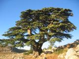 Lebanon Cedar2.7 mi
Explorer Tom This Lebanon Cedar has an ongoing feud with the rain, complaining that it gets in its hair too much. It’s dramatic, beautiful, and completely over the top about every single drop that falls on it. Go on a wet day, it suits the mood.
 Mellifont AbbeyVisitor attraction · 3.2 mi
 Not indicatedPassage tomb · 3.3 mi
Explorer Tom Passage tomb in Knowth made a New Year's resolution to stop losing kerbstones, but failed miserably again this year. It’s sitting right next to the big mound, looking slightly embarrassed about its missing bits. Go back in winter, it's a different animal.
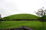 KnowthArchaeological place · 3.3 mi
 Oengus Óg: NewgrangeLegend location · 4.0 mi
Explorer Tom Oengus Óg: Newgrange gives this ancient monument a love story with a very odd ending: he finds Caer as a swan, becomes one himself and flies home with her. I was ready for a romantic walk; Oengus went straight for wings. Fair play to him.
 Dowth CastleCastle, tower house · 4.6 mi
Explorer Tom Dowth Castle in Dowth has been sitting on that ridge since 1234, looking smug about it. Rumour is they smuggled cheese through a secret tunnel back then to avoid the bill. Stop the car, it’s worth the hazard lights.
More archaeology and monuments in County Meath · All of County Meath

What do you know about this place?Tap to add a comment or ask a question