Places near here
Photo credits
- C O'Flanagan, Geograph · CC BY-SA 2.0
- Kieran Campbell, Geograph · CC BY-SA 2.0
- C O'Flanagan, Wikimedia Commons · CC BY-SA 2.0
- Zairon, Wikimedia Commons · CC BY 4.0
- SeoR, Wikimedia Commons · CC BY-SA 4.0
Explorer Tom Naul Bawn sits on a ravine edge next to a holy well, which is a great place to get wet and spiritually confused. It’s possibly part of Naul Castle, but mostly it’s just a wall with excellent views of the river. Toast it with a cup of tea and move on to the next adventure.
 church/chapel88 yd
Explorer Tom Church or chapel in Naul is a ruin from 1710, sitting in a graveyard with no roof. Just battered stone walls staring at the sky. It’s got a mysterious vibe. Take a spooky photo for us!
 OutlinedChapel · 95 yd
Explorer Tom Chapel in Naul is playing possum, hiding behind the Hussey family’s 1710 build. The medieval church got levelled, so this is the backup plan for history buffs. Ideal for a moody photo you'll pretend wasn't posed.
NaulMemorial · 165 ydExplorer Tom Naul in County Dublin is a memorial, but there's also a bar called Killian's Bar nearby. I bet people go to the bar after remembering something important. Find the bar and ask the bartender what exactly we're remembering here today.
 Séamus EnnisStatue · 193 yd
Explorer Tom Séamus Ennis would teach history by playing a tin whistle until you fell asleep and then waking you up with a rant. He’s a statue of a man who loved music more than he loved standing still. Have a look and decide if I was lying.
 Seamus Ennis Cultural CentreMemorial · 196 yd
Explorer Tom Seamus Ennis Cultural Centre was designed by a mother-in-law who thought all pipers needed better lighting. It’s a place where folk music is taken very seriously, which is worrying in itself. Practise your Irish on it, it won't correct you.
 Westown HouseCastle, tower house · 1123 yd
Explorer Tom Westown House in Westown is an 18th-century mansion that swallowed a medieval tower house whole like a very posh snack. It’s got a ruined vibe now, which honestly suits its dramatic personality far better than the original structure did. Bring a camera and your most suspicious face.
Naul HillMountain / peak · 1410 ydExplorer Tom Naul Hill has guest suites up top called The Loft. People rent them out there, so if you see anyone looking confused on the hillside, they probably just got lost trying to find their way back home.
 Passage tomb in FourknocksPassage tomb · 1.6 mi
 Passage tomb art in FourknocksPassage tomb art · 1.6 mi
 KnockbrackMountain / peak · 1.7 mi
Explorer Tom Knockbrack claims to be best friends with a famous actor who gets lost in the woods every time he visits for a shoot. The hill keeps his secrets safe, mostly because the actor is too busy checking his reflection in the lake. Spot the oldest stone and give it a name.
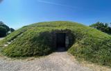 FourknocksPassage tomb · 2.1 mi
More historic places in County Dublin · All of County Dublin

What do you know about this place?Tap to add a comment or ask a question