What is recorded here
Possible bawn of Naul castle located on the E edge of a ravine on the S bank of the Delvin River, with holy well (DU004-045003-) 155m to E, church (DU004-045004-), graveyard (DU004-045005-) 80m to S, watermill (DU004-045001-) 200m to W, bridge (DU004-045008-) and castle (ME034-010----) 165m and 330m to WNW respectively and a mill (ME034-009----) 85m to NNW. The 1654-6 Civil Survey of Dublin recorded that in 'The Naal', there stood, 'one old Castle with an old Hall covered with straw one Orchard one garden plott tenn tenem[en]ts Valued by ye Jury at one hundred & seaventy five poundes'(Simington 1945, 30). On these lands there also stood 'one open stone Quarry also a grove of Ashtrees set for ornament' (ibid.). The possible bawn of Naul Castle also known as ‘The Black Castle’ was described by McDix (1896, 244) as follows; ‘The Castle is built close to a kind of rough angle formed by a turning in the rock or cliff, and a portion of a wall, or perhaps it might be called a buttress, projects from the north-east corner along the edge of the rock. This might, however, have been a portion of the external wall surrounding the bawn or yard. There appears, from the roof-pitch on the face of the north wall, that a building had been erected here against the Castle at a later date'. Geophysical survey (Licence no. 10R0077) was undertaken in the vicinity of Naul castle (DU004-045002-). A possible curving enclosure ditch was identified which corresponds to a possible ditch and bank identified as low earthworks. The ditch may represent an enclosing feature or bawn associated with the adjacent castle. A cluster of anomalies within the enclosing ditch may also indicate archaeological activity although no clear archaeological patterns are visible (Harrison 2010, 6).
Possible bawn of Naul castle located on the E edge of a ravine on the S bank of the Delvin River, with holy well (DU004-045003-) 155m to E, church (DU004-045004-), graveyard (DU004-045005-) 80m to S, watermill (DU004-045001-) 200m to W, bridge (DU004-045008-) and castle (ME034-010----) 165m and 330m to WNW respectively and a mill (ME034-009----) 85m to NNW. The 1654-6 Civil Survey of Dublin recorded that in 'The…
From the National Monuments Service (Archaeological Survey of Ireland) record DU004-045009
The monument record does not grant public access. Check the route and ask the landowner before entering private land.
- What survives
- Recorded monument
Places near here
 church/chapel129 yd
 OutlinedChapel · 137 yd
 Seamus Ennis Cultural CentreMemorial · 226 yd
 Westown HouseCastle, tower house · 1136 yd
 Passage tomb in FourknocksPassage tomb · 1.6 mi
 Passage tomb art in FourknocksPassage tomb art · 1.6 mi
 KnockbrackMountain / peak · 1.7 mi
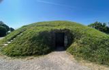 FourknocksPassage tomb · 2.0 mi
 Hollywood GreatMountain / peak · 2.4 mi
 European Yew3.9 miEuropean Yew3.9 mi
 Thomas AsheMemorial · 6.2 mi
Pictures: C O'Flanagan, Geograph · CC BY-SA 2.0; Kieran Campbell, Geograph · CC BY-SA 2.0; Zairon, Wikimedia Commons · CC BY 4.0; SeoR, Wikimedia Commons · CC BY-SA 4.0; Sitomon, Wikimedia Commons · CC BY-SA 2.0; FrankFlanagan, Wikimedia Commons · CC0
More castles and forts in County Dublin · All of County Dublin
What do you know about this place?