What is recorded here
From the National Monuments Service (Archaeological Survey of Ireland) record DU024-068
Places near here
Photo credits
- Jonathan Billinger, Geograph · CC BY-SA 2.0
- National Inventory of Architectural Heritage
- Maker not stated on source page, www.flickr.com
- Maker not stated on source page, en.wikipedia.org
- Maker not stated on source page, in.pinterest.com
- Colin Park, Geograph · CC BY-SA 2.0
- Maker not stated on source page, www.tripadvisor.com.au
- Golfing in Ireland; photographer not stated, Source publisher
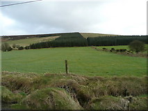 Butter MountainMountain / peak · 764 yd
Explorer Tom Butter Mountain would use its lotto win to buy every single stick of butter in Ireland and build a palace out of them.…
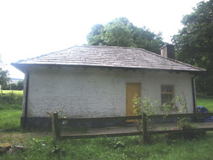 Talbotstown HouseGate lodge · 1500 yd
Explorer Tom Talbotstown House in Aghfarrell has a gate lodge with such unpretentious charm it could be a bit of a diva about its…
 Enclosure in BallyfolanEnclosure · 1508 yd
Explorer Tom The local pub claims someone in Ballyfolan invented this rectangular enclosure because they were bored one Tuesday…
 Flat cemetery in AghfarrellFlat cemetery · 1665 yd
Explorer Tom Flat cemetery in Aghfarrell is on top of Ballinacorney Hill, where a guy from long ago was buried with a bowl of food…
 Passage tomb in Ballinascorney UpperPassage tomb · 1.0 mi
Explorer Tom Passage tomb in Ballinascorney Upper is proud of its displaced kerbstones, claiming they’re actually part of a fancy…
 Megalithic structure in Ballinascorney UpperMegalithic structure · 1.0 mi
Explorer Tom Megalithic structure in Ballinascorney Upper is a square chamber under peat. It sits SE of a cairn with views to the…
 SeahanMountain / peak · 1.0 mi
Explorer Tom Seahan was foggy on the morning I looked it up. It might still be wrapped in mist, so if you can’t see anything, just…
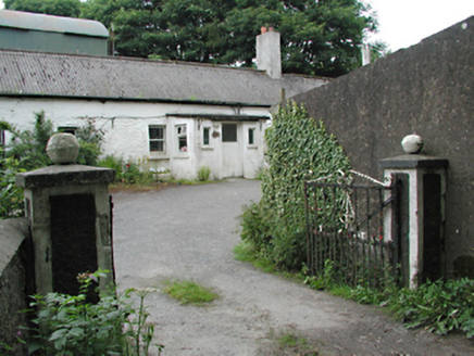 farmyard complex1.2 mi
Explorer Tom Farmyard complex in Aghfarrell caused the whole parish to argue about whether the roof tiles were on crooked or…
 Stone circle in Ballinascorney UpperStone circle · 1.2 mi
Explorer Tom This stone circle in Ballinascorney Upper was described by Price in 1940 but hasn’t been found since. It’s basically a…
 Black HillMountain / peak · 1.2 mi
Explorer Tom Black Hill in County Dublin is totally forested and looked at from Bohernabreena Road. It’s dark and mysterious inside…
 Slade Valley Golf ClubGolf course · 1.7 mi
 Butter Mountain Golf ClubGolf course · 1.7 mi
More historic places in County Dublin · All of County Dublin

What do you know about this place?Tap to add a comment or ask a question