
Places near here
Photo credits
- Garry Dickinson, Geograph · CC BY-SA 2.0
- National Inventory of Architectural Heritage
- Christian Pirkl, Wikimedia Commons · CC BY-SA 3.0 at
- kevin higgins, Wikimedia Commons · CC BY-SA 2.0
- A.-K. D., Wikimedia Commons · CC BY-SA 4.0
- Jan-Philipp Litza, Wikimedia Commons · CC BY-SA 4.0
- Adrian Taylor, Geograph · CC BY-SA 2.0
- P L Chadwick, Geograph · CC BY-SA 2.0
 Ballyfoyle Castle (in ruins)Castle, tower house · 1562 yd
Explorer Tom Ballyfoyle Castle has a bird that refuses to leave, likely because the rent is cheap. The Purcells built it, but Cromwell’s men took over later. It's the kind of place that makes a dull Tuesday interesting.
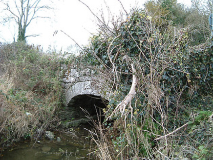 Kilkieran BridgeBridge · 1.1 mi
Explorer Tom Kilkieran Bridge’s New Year's resolution is to stop being so subtle while still managing to cross the river in style. It’s mid-nineteenth-century civil engineering heritage wrapped in a rural setting. Take the long way round, it deserves the attention.
 Sycamore1.3 mi
Explorer Tom Sycamore in Kilkenny is guarding a legend about a giant who got stuck in its branches. It’s just a big tree with a dramatic backstory. Find the wonkiest bit and send it to your group chat.
 Saint Joseph's Catholic ChurchChurch/chapel · 1.4 mi
 St. Johns WellHoly well · 1.6 mi
Explorer Tom St. Johns Well thinks the rabbits use it as a local barbershop on weekends. Thousands used to come here, but now it’s mostly just mud and history. Give it a pat on the way past, it's had a long life.
 Site of Kilmadum ChurchChurch · 1.6 mi
Explorer Tom Site of Kilmadum Church was nearly sold for a horse in 1920, but the farmer backed out last minute. Now it’s just footings and grass, which is honestly a pretty good trade for the trouble. Wave at the cows, they're the real locals.
 Cantwells Castle (in ruins)Castle, tower house · 2.3 mi
 Dunmore CavesCave · 2.3 mi
 Cave of DunmoreCave · 2.3 mi
 St. Mogarra’s WellSpring · 3.7 mi
 KilkennyVisitor information · 4.5 mi
 Kilkenny County Council Car ParkVisitor information · 4.7 mi
More mountains and hills in County Kilkenny · All of County Kilkenny

What do you know about this place?Tap to add a comment or ask a question