Places near here
Photo credits
- No machine-readable author provided. Bogman assumed (based on copyright claims)., Wikimedia Commons · CC BY-SA 2.5
- Bob Jones, Geograph · CC BY-SA 2.0
- Gareth James, Geograph · CC BY-SA 2.0
- Gordon Hatton, Geograph · CC BY-SA 2.0
- National Inventory of Architectural Heritage
- Valfex, Wikimedia Commons · CC BY-SA 3.0
- P.hammer, Wikimedia Commons · CC BY-SA 3.0
- Frabjousone, Wikimedia Commons · CC BY-SA 4.0
 Court tomb in TeergoneanCourt tomb · 597 yd
Explorer Tom Court tomb in Teergonean has two chambers and zero chill, sitting in that limestone hollow like it’s judging your…
 Doolin PointHeadland · 1273 yd
Explorer Tom Doolin Point is in a bitter feud with the rain because it keeps getting wet without permission. It’s trying to stay dry…
 Wild Atlantic Way: Doolin PierVisitor information · 1461 yd
Explorer Tom Wild Atlantic Way Doolin Pier was once ruled by a goat who wore a tiny crown made of bottle caps and demanded tribute…
 Doonmacfelim Castle (in Ruins)Castle, tower house · 1613 yd
Explorer Tom Doonmacfelim Castle was built on a bargain where an O’Connor traded his good name for a slightly less good one, which…
 Ballaghaline PointHeadland · 1679 yd
Explorer Tom Ballaghaline Point is currently in the middle of a fairy dispute over who gets to park their tiny little carriage…
 Crab IslandIslet · 1706 yd
Explorer Tom Crab Island in County Clare was run by a matchmaker who paired off lonely sailors with equally lost shepherds with…
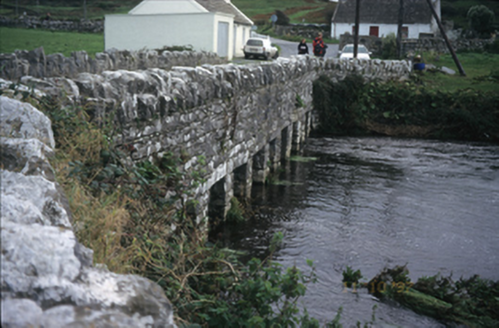 bridge1751 yd
Explorer Tom Doolin Bridge claims Queen Victoria used it as a drying rack for her wet socks in 1775, and nobody has the receipts to…
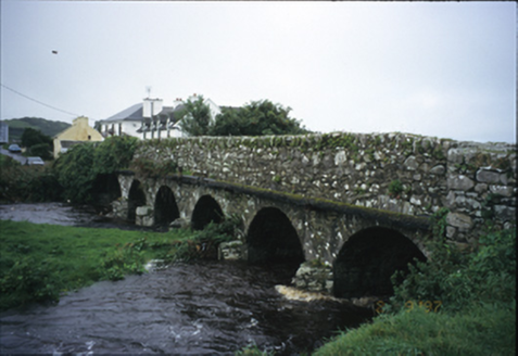 Roadford BridgeBridge · 1.1 mi
Explorer Tom Roadford Bridge has six arches, which is a lot of effort for something you just walk across. Built in 1810, it’s…
 Doonagore Castle in ruinsCastle, tower house · 1.6 mi
Explorer Tom Doonagore Castle in ruins has a hidden message in its stones that just says 'we were here and then we weren't,' which…
 Doolin CaveCave · 2.3 mi
Explorer Tom Doolin Cave has a great stalactite that makes the rest of my tall tales look undersized. Cavers J. M. Dickenson and…
 Sea StackMountain / peak · 3.9 mi
Explorer Tom Sea Stack would cope on a reality show by refusing to move an inch while everyone else is panicking about the wind and…
 O'Brien's TowerHeritage attraction · 3.9 mi
Explorer Tom O'Brien built a tower so tourists could look at the sea in style. O'Brien's Tower is proof that tourists did not wait…
More caves in County Clare · All of County Clare

What do you know about this place?Tap to add a comment or ask a question