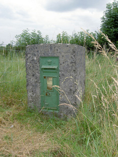
What is recorded here
Cast-iron post box, cast c. 1890, having 'VR' royal cipher and raised crown motif. Raised ‘Post Office’ lettering to letter flap and foundry name to the base, now illegible. Set into rendered pier adjacent to rural crossroad junction at Ballyclamy. Located to the southeast of Ballymahon, and to the southeast of…
Read the whole record
From the Buildings of Ireland (National Inventory of Architectural Heritage) record 13402727
Places near here
Photo credits
- Maker not stated on source page, www.pinterest.com
- National Inventory of Architectural Heritage
- Maker not stated on source page, commons.wikimedia.org
- Maker named on the Wikimedia Commons picture page · CC BY-SA 2.5
- Sarah777, Geograph · CC BY-SA 2.0
- Maker not stated on source page, uk.pinterest.com
- Maker not stated on source page, storage.googleapis.com
- Maker not stated on source page, in.pinterest.com
 Fairy fort / earthen ringfort in ForgneyFairy fort / earthen ringfort · 196 yd
Explorer Tom Fairy fort / earthen ringfort in Forgney was once ruled by a goat named Gerald who demanded tribute of clover every…
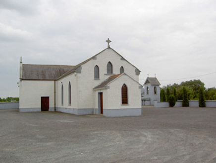 Catholic Church of the Immaculate ConceptionChurch/chapel · 439 yd
Explorer Tom Catholic Church of the Immaculate Conception hears the neighbours arguing through its walls at three in the morning.…
 Earthwork in Clooneen (shrule By.)Earthwork · 938 yd
Explorer Tom Earthwork in Clooneen is basically a giant grassy donut that a goat once ruled with an iron hoof. It’s half-buried but…
 NewcastleGates/railings/walls · 1.1 mi
Explorer Tom Newcastle gates in Forgney are so fancy they probably charge admission just to look at their own ironwork. A goat once…
 Sessile Oak1.1 mi
Explorer Tom Sessile Oak in County Westmeath is standing there looking distinctly smug, probably judging your life choices from its…
 Saint Munis's Church (Forgney)Church/chapel · 1.2 mi
Explorer Tom Saint Munis's Church (Forgney) in Forgney, County Longford has an imaginary fan club that meets every full moon to…
 Mapped cemeteryCemetery · 1.2 mi
Explorer Tom Mapped cemetery is another one of those spots where the map makers clearly fell asleep and left the pen in the middle…
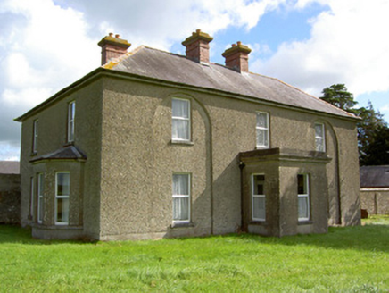 Rath LodgeHouse · 1.4 mi
Explorer Tom Rath Lodge in Rath had a fox take charge of the keys once and never gave them back. Those blind arches are weirdly…
 Cloncullen HouseHouse · 1.6 mi
Explorer Tom Cloncullen House has been chopped down by a storey and now looks like it’s wearing a hat that’s slightly too small for…
 CastleCastle, unclassified · 1.7 mi
Explorer Tom Castle in Newcastle is sick of being asked if Robert the Bruce actually burnt it down. It says it was a cooking…
 Earthwork in MoyvoreEarthwork · 1.9 mi
Explorer Tom Earthwork in Moyvore started from a bet two lads made in the pub about where to plant trees. It’s a circular hillock…
 Peter Egan Park, St. Munis GAA, ForgneyGAA ground · 2.0 mi
More historic places in County Longford · All of County Longford

What do you know about this place?Tap to add a comment or ask a question