What is recorded here
Situated on the coast at Polshone Head with the sea immedately adjacent NW-SE and a ravine on the S side. This grass-covered area is defended by two fosses. The inner enclosure is subcircular or D-shaped (dims. 32m E-W; 29m N-S) defined by scarps (H 1.6-2m) at N and S and destroyed by sea erosion at E, but a curving bank (Wth 5m; int. H 0.4m; ext. H 1.2m) with an external fosse (Wth of top 8m; Wth of base 3m; D 1.2m) and counterscarp bank (Wth c. 4m; ext. H 0.3m) survive S-NW. The outer enclosure to the W is triangular (dims. 28m E-W; 23m N-S at E) with the apex at W whre it is defined by a fosse across the promontory (Wth of top 6m; D 2m). The inner enclosure may have been a rath imposed on earlier defences.
Situated on the coast at Polshone Head with the sea immedately adjacent NW-SE and a ravine on the S side. This grass-covered area is defended by two fosses. The inner enclosure is subcircular or D-shaped (dims. 32m E-W; 29m N-S) defined by scarps (H 1.6-2m) at N and S and destroyed by sea erosion at E, but a curving bank (Wth 5m; int. H 0.4m; ext. H 1.2m) with an external fosse (Wth of top 8m; Wth of base 3m; D…
From the National Monuments Service (Archaeological Survey of Ireland) record WX012-012
The monument record does not grant public access. Check the route and ask the landowner before entering private land.
- What survives
- Recorded monument
Places near here
Photo credits
- National Inventory of Architectural Heritage
- Andreas F. Borchert, Wikimedia Commons · CC BY-SA 4.0
- Lucarelli, Wikimedia Commons · CC BY-SA 3.0
- Smirkybec, Wikimedia Commons · CC BY-SA 4.0
- Ryanforsyth9, Wikimedia Commons · CC BY-SA 4.0
 Glendoyne CottageHouse · 747 yd
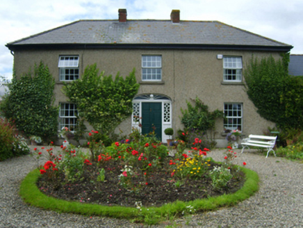 Glen HouseFarm house · 933 ydPromontory fortPromontory fort, coastal · 1173 ydIndicatedCastle, motte and bailey · 1.0 miShort Strand BeachBeach / strand · 1.1 miRoney Point BeachBeach / strand · 1.2 miCourtown Amusement CentreHeritage attraction · 1.9 miCourtown WoodsWood · 2.4 mi
 Glascarrig AbbeyArchaeological place · 2.5 mi
 Holm Oak2.5 mi
 Market HouseHeritage attraction · 5.0 mi
 1798 MonumentMemorial · 5.1 mi
More archaeology and monuments in County Wexford · All of County Wexford
What do you know about this place?