Places near here
Photo credits
- The original uploader was Rwxrwxrwx at English Wikipedia ., Wikimedia Commons · CC BY-SA 3.0
- Andy Waddington, Wikimedia Commons · CC BY-SA 2.0
- National Inventory of Architectural Heritage
- P L Chadwick, Geograph · Creative Commons Attribution-ShareAlike 2.0
- Colin Park, Geograph · CC BY-SA 2.0
- P.hammer, Wikimedia Commons · CC BY-SA 3.0
- Roger Diel, Geograph · CC BY-SA 2.0
- John M, Geograph · CC BY-SA 2.0
- No machine-readable author provided. Bogman assumed (based on copyright claims)., Wikimedia Commons · CC BY-SA 2.5
 AilladieCliff · 1.1 mi
Explorer Tom Ailladie stands tall as a cliff in County Clare, perfect for spotting climbers scaling its impressive middle sectors today.
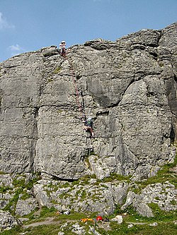 BallyryanCliff · 1.2 mi
Explorer Tom Ballyryan is a lovely limestone cliff in County Clare, just right for quick, sunny climbs with friends on a nice day.
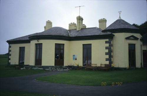 Ballinalacken CastleHouse · 2.0 mi
Explorer Tom Ballinalacken Castle in Ballynalackan is playing dress-up, swapping castle vibes for hotel chic with its new wing. It looks like it’s trying too hard to impress the tourists. Tell the kids it's a castle. Close enough.
 Grave YardGraveyard · 2.3 mi
Explorer Tom Graveyard in Craggagh would cope brilliantly on a reality show because it has great views and zero drama. St. Onchon built it ages ago and left it to rot stylishly. Practise your Irish on it, it won't correct you.
 FaunarooskaCave · 2.3 mi
Explorer Tom Faunarooska sits on the Burren, near Black Head; I picture dramatic cliffs and winds that make your hair stand up.
 Doolin CaveCave · 2.4 mi
Explorer Tom Doolin Cave stands proud in County Clare, and I can practically hear the sea echoing off its stone walls.
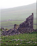 Faunarooska Castle (in ruins)Castle, tower house · 2.5 mi
Explorer Tom Faunarooska Castle in Faunarooska is planning its retirement on the slopes of Slieve Elva. It looks like it’s napping with one eye open at the Aran Islands. Hum something sad nearby, it adds atmosphere.
 Slieve ElvaMountain / peak · 2.8 mi
Explorer Tom Slieve Elva, a peak that’s as isolated as the bog land that surrounds it in County Clare.
 Fanore BeachVisitor information · 3.5 mi
Explorer Tom Fanore Beach has me checking if the rain is just a metaphor for the mood I'm in
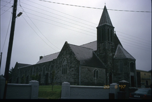 Corpus Christi Catholic ChurchChurch/chapel · 3.6 mi
Explorer Tom Corpus Christi Catholic Church in Rathbaun is trying very hard to look important with its tower and spire. Best seen with a hangover and a sausage roll, because the spiritual energy helps you forgive yourself for the greasy breakfast choice.
 Site of Lisdoonvarna CastleCastle, tower house · 3.9 mi
Explorer Tom Site of Lisdoonvarna Castle would be a total disaster on a reality show, probably losing its footing in episode one. It’s a bit of a mess now, but ideal stop for a big stretch and a bigger yawn.
 Court tomb in TeergoneanCourt tomb · 3.9 mi
Explorer Tom Court tomb in Teergonean has two chambers and zero chill, sitting in that limestone hollow like it’s judging your hiking boots. It looks like a fancy stone house for ghosts who like privacy. Get a photo with it before it gets a better agent.
More caves in County Clare · All of County Clare

What do you know about this place?Tap to add a comment or ask a question