What is recorded here
From OpenStreetMap (© OpenStreetMap contributors) w225974212
Places near here
Photo credits
- Eskerroe, Wikimedia Commons · CC BY-SA 4.0
- Harold Strong, Wikimedia Commons · CC BY-SA 2.0
- Laurel Lodged, Wikimedia Commons · CC BY-SA 3.0
- Christine Matthews, Geograph · CC BY-SA 2.0
- Colin Park, Geograph · CC BY-SA 2.0
- National Inventory of Architectural Heritage
- louise price, Wikimedia Commons · CC BY-SA 2.0
- Chairego apc, Wikimedia Commons · CC BY-SA 4.0
- Jjm596, Wikimedia Commons · CC BY-SA 4.0
 St. Cavans ChurchChurch · 593 yd
Explorer Tom St. Cavans Church on Inis Oírr ended up in the wrong place because someone misread the map badly. It has a sacristy that looks like an afterthought, but it’s still standing firm. Best visited with a curious kid and no timetable.
Port na CilleBeach / strand · 630 yd MV PlassyHeritage attraction · 975 ydGob na CoraHeadland · 975 yd
 Caisleán Uí BhriainCastle · 990 yd
 Furmina Castle (in ruins)Castle, hall-house · 992 yd
Explorer Tom Furmina Castle in Inis Oírr is a hall-house that's seen better centuries. It's basically a giant box where people used to argue about land rights. Make a wish, it's had centuries of practice listening to complaints.
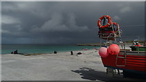 Lár na TráBeach / strand · 1025 yd
 signal tower1067 yd
Explorer Tom Signal tower in Inisheer has a superstition that locals swear by if you wave at it wrong. It’s dressed limestone and all business about French invasions from way back. Bring the dog, it'll have opinions.
 Creggankeel FortFairy fort / stone ringfort · 1218 yd
Explorer Tom Creggankeel Fort on Inis Oírr was nearly sold for a horse in a very bad bet. The wall is two and a half meters high, which is impressive if you’re a gnome. Look up, the best bit is always higher than you think.
 Cnoc RaithníVisitor information · 1278 yd
 Cill GhobnaitHeritage attraction · 1726 yd
 Inis OírrIsland · 1.1 mi
More beaches and strands in County Galway · All of County Galway

What do you know about this place?Tap to add a comment or ask a question