What is recorded here
From OpenStreetMap (© OpenStreetMap contributors) n12181005047
Places near here
Photo credits
- Harold Strong, Wikimedia Commons · CC BY-SA 2.0
- Maker not stated on source page, commons.wikimedia.org
- Maker not stated on source page, www.tripadvisor.co.za
- louise price, Wikimedia Commons · CC BY-SA 2.0
- Eskerroe, Wikimedia Commons · CC BY-SA 4.0
- Laurel Lodged, Wikimedia Commons · CC BY-SA 3.0
- Christine Matthews, Geograph · CC BY-SA 2.0
- Colin Park, Geograph · CC BY-SA 2.0
- Paddy / Wild Irish Walks; individual photographer not separately named, wildirishwalks.ie
- Karie Kuiper, Wikimedia Commons · CC BY-SA 4.0
- Maker not stated on source page, it.pinterest.com
- Jjm596, Wikimedia Commons · CC BY-SA 4.0
 MV PlassyHeritage attraction · 171 yd
Explorer Tom You know that rusty ship from Father Ted? It had a whole working life before television borrowed its good side. MV…
 Graveyard in Inis OírrGraveyard · 1001 yd
Explorer Tom Graveyard in Inis Oírr is in a constant feud with the rain. The stones are wet, grumpy, and definitely judging your…
 Church in Inis OírrChurch · 1249 yd
Explorer Tom Church in Inis Oírr was once offered for sale by a cow who thought it was a nice shed. It’s still out there somewhere…
 Creggankeel FortFairy fort / stone ringfort · 1269 yd
Explorer Tom Creggankeel Fort on Inis Oírr was nearly sold for a horse in a very bad bet. The wall is two and a half meters high…
 St. Cavans ChurchChurch · 1318 yd
Explorer Tom St. Cavans Church on Inis Oírr ended up in the wrong place because someone misread the map badly. It has a sacristy…
 Caisleán Uí BhriainCastle · 1483 yd
Explorer Tom O'Brien's Castle stands high on Inisheer as if the island asked for a lookout and received a family argument as well. A…
 Furmina Castle (in ruins)Castle, hall-house · 1485 yd
Explorer Tom Furmina Castle in Inis Oírr is a hall-house that's seen better centuries. It's basically a giant box where people used…
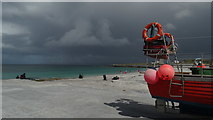 Lár na TráBeach / strand · 1.0 mi
Explorer Tom Lár na Trá has a local superstition that says if you blink three times, the tide will take your left shoe as payment. I…
 Páirc Peil Inis Oírr, clg Oileáin ÁrannGAA ground · 1.0 mi
 Cnoc RaithníHeritage attraction · 1.1 mi
Explorer Tom A short stroll from the pier on Inis Oírr brings you to Cnoc Raithní, a low stone mound with a rather outrageous talent…
 Megalithic structure in Inis OírrMegalithic structure · 1.1 mi
Explorer Tom Megalithic structure in Inis Oírr does some weird stuff when nobody’s looking, probably rearranging its own stones just…
 Inis OírrIsland · 1.1 mi
Explorer Tom I would bring a calendar to Inis Oírr, then promptly lose track of the centuries. Inis Oírr may be the smallest Aran…
More cliffs, bays and coast in County Galway · All of County Galway

What do you know about this place?Tap to add a comment or ask a question