Places near here
Photo credits
- Kieran Campbell, Geograph · CC BY-SA 2.0
- National Inventory of Architectural Heritage
- Stephan van Helden, Wikimedia Commons · CC BY-SA 4.0
- Malene Thyssen, Wikimedia Commons · CC BY-SA 3.0
- David Crozier, Wikimedia Commons · CC BY-SA 2.0
- Eric Jones, Wikimedia Commons · CC BY-SA 2.0
Explorer Tom Fairy fort / earthen ringfort in Aghateskin is having a serious feud with the rain about its scarp. It’s perched on a slope, looking smug while everything else slides off. If it rains, blame me, not the earth.
fortsFairy fort / earthen ringfort · 1310 ydTobernagalliaghSpring · 1376 yd Mannan Castle (in ruins)Castle, Anglo-Norman masonry castle · 1.1 mi
 Donaghmoyne Post OfficeHouse · 1.1 mi
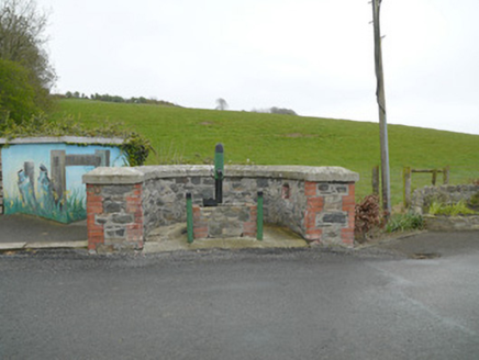 water pump1.1 mi
Explorer Tom Water pump in Cordrummans Middle would tell you after a few pints that the water tastes like regret and iron. Gaskin Brothers made it, which sounds like a band from Dundalk. Bring your nan to remember when this was cool.
Mannan CastleArchaeological place · 1.1 miKnockreaghMountain / peak · 3.0 mi Horse-chestnut3.2 mi
 European Beech4.1 mi
Explorer Tom This European Beech handles nosy neighbours by dropping exactly one leaf on their heads every morning as a warning. It’s subtle but deadly effective. Tell the next person you meet it's haunted. It might be.
 Lough Ross Amenity AreaPark · 4.7 mi
Explorer Tom Lough Ross Amenity Area in County Armagh was where a priest once lost a bet about whether ducks could fly backwards, which he swears he did not actually lose. He has been embarrassed ever since and tries to avoid the place whenever possible, making it even more mysterious. Bring a friend who talks too much and let the place shut them up.
 Battle of Newry RoadBattle · 6.3 mi
Explorer Tom Battle of Newry Road in County Armagh gave up chocolate for Lent because it was stressed about the whole military thing. It’s a road with commitment issues, really. Pick a stone, any stone, and invent its tragic biography.
More caves in County Monaghan · All of County Monaghan

What do you know about this place?Tap to add a comment or ask a question