
Places near here
Photo credits
- National Inventory of Architectural Heritage
- SirGarick, Wikimedia Commons · CC BY-SA 4.0
- Garry Dickinson, Geograph · CC BY-SA 2.0
- Andreas F. Borchert, Wikimedia Commons · CC BY-SA 4.0
- P L Chadwick, Geograph · CC BY-SA 2.0
- Oliver Dixon, Geograph · Creative Commons Attribution-ShareAlike 2.0
- Discover Lough Derg, Wikimedia Commons · CC BY-SA 2.0
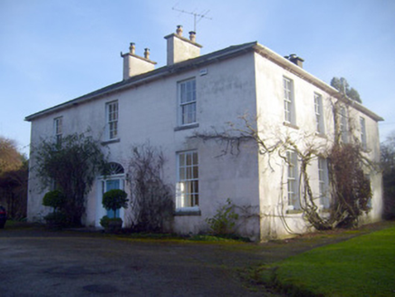 Gardenhill HouseCountry house · 879 yd
Explorer Tom Gardenhill House in Gardenhill is stuck in a feud over who owns the best view from the ornate doorway. The Blackhall family built it, and it still looks like it’s waiting for them to return. Snap one photo, then apologize to the house for intruding.
 Woodpark HouseHouse · 1096 yd
Explorer Tom Woodpark House in Coolreiry is standing there looking all smug in its fancy limestone portico, like a well-dressed gentleman who refuses to tip. It’s got that 'substantial' vibe that screams 'please don’t touch my decorative render,' which is basically the only rule you need to survive this beautiful little mystery. Give it a good wave from the road and ask if it’s lonely yet. It’s definitely judging your footwear.
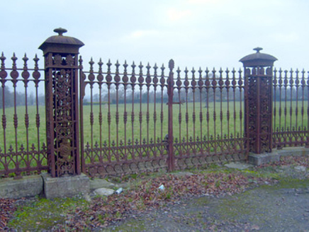 HermitageDemesne walls/gates/railings · 1396 yd
Explorer Tom Hermitage in Limerick is all about those fancy gates that scream 'look at my craftsmanship.' They’re like the gatekeepers of good taste, standing tall and proud on the roadside. The blacksmiths who made these must have been showing off a bit too much, but hey, we love a show-off. Don’t lean against them; they bite.
 post box1396 yd
Explorer Tom Post box in Coolreiry survives zombie attacks by being too small to bite. The crown motif is its royal armor against the undead. Toast it with a cup of tea, then drop your letter inside.
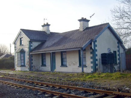 Lisnagry Railway StationRailway station · 1429 yd
Explorer Tom Lisnagry Railway Station in Ballynacourty hasn’t had a train since 1858 but still acts like it’s late for something. It would post 'waiting for you' on social media if it could. Pop by and tell it it's still running on time.
 Castle ConnellRuins · 1.1 mi
Explorer Tom Castle Connell hosted a fiddler who played all night long, and the castle never let him stop until he dropped dead. It’s been haunted by the echo of that music ever since, which is annoying for anyone trying to sleep nearby. If it rains, blame me.
 Castle Connell (in ruins)Castle, Anglo-Norman masonry castle · 1.1 mi
Explorer Tom Castle Connell in Coolbane started because two lads made a bet in a pub about who could build bigger. King John agreed to pay for it, which is how most bad decisions happen. Go in good boots and better humour, trust me.
Campus MapVisitor information · 3.7 miExplorer Tom Campus Map in Limerick is actually run by a dog who barks at anyone trying to find the library before he has had his morning walk. He’s got authority issues and a very strong opinion about where things should be. Bring a pen pal, they'll be jealous.
 Cath.Cathedral · 7.8 mi
Explorer Tom Cathedral in Shantraud is hiding its light under a very large bushel of mystery. The locals probably think the roof leaks because they forgot to pay the celestial plumber. It’s a proper spot for a flask of tea and a big, confused think about history.
 Brian Boru Heritage CentreVisitor information · 7.8 mi
Explorer Tom Brian Boru Heritage Centre in County Clare is hiding a treasure chest inside the library that definitely contains nothing but stale biscuits and old newspapers. The lock-keeper’s ghost is still guarding it for no reason. Ten minutes here and you'll have a yarn for the pub.
 TobermurraghHoly well · 7.9 mi
Explorer Tom Tobermurragh in Knockyclovaun was once taken over by a fox who demanded tribute in exchange for guarding the water supply. The red brick enclosure stands as a monument to that brief but chaotic reign of canine authority and questionable judgment. Linger, it's not going anywhere and neither should you, really.
 Brian Boru FortHeritage attraction · 8.5 mi
Explorer Tom Brian Boru's Fort is a grand name, and I would be the first to announce the king built every bank by hand. Archaeology asks for more care. Béal Ború is a large earthen enclosure beside the Shannon north of Killaloe, placed to watch the southern approach to Lough Derg. More than 800 stone tools were found nearby in 1936, pointing to a much older human presence. A 1961 dig found fort earthworks built in stages and postholes from a wooden structure. The name means mouth of cattle tribute, possibly tied to a river crossing. Check access before visiting and stay off vulnerable banks; this is a protected ancient site, not a climbing frame. Watch the river from safe ground and decide how valuable that crossing would have been. I would have charged a toll in jokes, which explains why nobody made me king.
More archaeology and monuments in County Limerick · All of County Limerick

What do you know about this place?Tap to add a comment or ask a question