
What is recorded here
In pasture 180m E of ringfort (LI039-025----). Not depicted on OSi historic maps. Identified as BGE 3/75/4-5 in 2002 by Ken Wiggins (Licence 02E0119) during topsoil-stripping on the Bord Gáis Éireann Pipeline to the West. Excavated in 2002 by Brian Halpin under licence No. 02E0394 the results of which were summarised…
Read the whole record
From the National Monuments Service (Archaeological Survey of Ireland) record LI039-190
Places near here
Photo credits
- Maker not stated on source page, commons.wikimedia.org
- Maker not stated on source page, www.flickr.com
- National Inventory of Architectural Heritage
- Kmcnamee, Wikimedia Commons · CC BY-SA 4.0
- Maker not stated on source page, au.pinterest.com
- Maker not stated on source page, www.youtube.com
- Dromin Athlacca Banogue club; individual photographer not named, drominathlaccabanogue.clubzap.com
- No machine-readable author provided. Christian1965~commonswiki assumed (based on copyright claims)., Wikimedia Commons · Public domain
- SteveODowd, Wikimedia Commons · CC BY-SA 4.0
- Mike Searle, Geograph · CC BY-SA 2.0
 Rathcannon Castle (in ruins)Castle, tower house · 1131 yd
Explorer Tom Rathcannon Castle has a long list of former names because it’s been playing dress-up since the middle ages. It’s a…
 Fairy fort / earthen ringfort in DrombegFairy fort / earthen ringfort · 1747 yd
Explorer Tom This Drombeg ringfort has a secret fan club of confused sheep who graze right next to the causeway. It’s just a big…
 Catholic Church of Saint John the BaptistChurch/chapel · 1.0 mi
Explorer Tom Catholic Church of Saint John the Baptist in Rathcannon had a matchmaker who married off half the village. She vanished…
 Dromin/Athlacca GAA pitchGAA ground · 1.1 mi
 chimney1.1 mi
Explorer Tom Chimney in Athlacca South is the last stand of a creamery complex that vanished into thin air and became a housing…
 Athlacca BridgeBridge · 1.1 mi
Explorer Tom Athlacca Bridge was built on a bargain where the river agreed to stay calm for four arches. It’s got that early…
 Church in Athlacca SouthChurch · 1.2 mi
Explorer Tom Church in Athlacca South had no surface remains left when the new church was built in 1813, so the builder probably…
 Earthwork in Crean (smallcounty By.)Earthwork · 2.0 mi
Explorer Tom Earthwork in Crean keeps getting picked on by the wind because it refuses to grow any taller, sticking to its 23-meter…
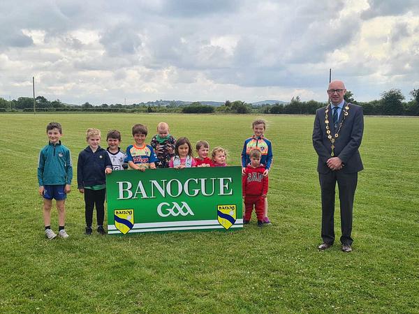 Banogue GAA pitchGAA ground · 2.4 mi
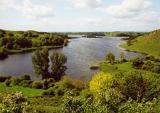 Áine and Gearóid Iarla: Lough GurLegend location · 5.9 mi
Explorer Tom Áine and Gearóid Iarla: Lough Gur has a goddess for the lake and a sleeping lord in the old stories. I thought I was…
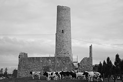 Dysert AenghusaHeritage attraction · 6.1 mi
Explorer Tom Dysert Oenghusa near Croom brings a round tower, a ruined church and a graveyard together in one quiet Limerick field…
 Castle (in ruins)Castle, tower house · 6.5 mi
Explorer Tom Fantstown Castle would describe itself to a stranger as 'slightly damp, historically significant, and currently…
More archaeology and monuments in County Limerick · All of County Limerick

What do you know about this place?Tap to add a comment or ask a question