
Places near here
Photo credits
- National Inventory of Architectural Heritage
- Kmcnamee, Wikimedia Commons · CC BY-SA 4.0
- Pgakeenan, Wikimedia Commons · CC BY-SA 4.0
- Harold Strong, Geograph · CC BY-SA 2.0
- TeaTimeJ, Wikimedia Commons · CC BY-SA 4.0
- Rob Hurson, Wikimedia Commons · CC BY-SA 4.0
- The British Library, Wikimedia Commons · No restrictions
- EecherplazGinkgo06.jpg : Cayambe derivative work: Ginkgotree ( talk ), Wikimedia Commons · CC BY-SA 3.0
- Laurel Lodged, Wikimedia Commons · CC BY-SA 4.0
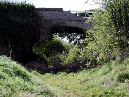 bridge317 yd
Explorer Tom This Bennetstown bridge was built after two lads bet in the pub that masons could make stone look tough. They won…
 St. Paul's GAA pitchGAA ground · 1123 yd
 Catholic Church of Saint Peter and Saint PaulChurch/chapel · 1325 yd
Explorer Tom Catholic Church of Saint Peter and Saint Paul in Dunboyne has a copper roof that must feel a bit heavy after all those…
St. Peter's GAA, DunboyneGAA ground · 1.4 mi TyrrelstownWood · 3.0 mi
Explorer Tom Tyrrelstown had a moment where a fox took charge of the whole operation and decided it was the new king of the hill.…
 Ladys WellHoly well · 3.4 mi
Explorer Tom Ladys Well in Tyrrelstown is dedicated to the Blessed Virgin Mary, but it looks more like a stone shrine that got tired…
 Graveyard in BuzzardstownGraveyard · 3.4 mi
Explorer Tom Graveyard in Buzzardstown has strict visitor rules: no touching the reused architectural fragments or they’ll bite you…
 Church, GraveyardChurch · 3.6 mi
Explorer Tom The Church in Clonsilla had a poet fall in the ditch nearby who wrote a sonnet about his muddy socks. It has stood on…
 MoatMound · 3.9 mi
Explorer Tom Moat in Corduff is completely covered in brambles, looking like a giant green hedge that’s been left out in the rain…
 Luttrellstown CastleCastle · 4.1 mi
Explorer Tom Luttrellstown Castle in County Dublin has been featured in an 1898 book about picturesque Dublin, which makes it sound…
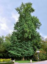 Ginkgo4.4 mi
Explorer Tom Ginkgo in County Dublin is an absolute fossil, older than your grandma’s dentures and twice as opinionated. It claims…
 Castleknock CastleCastle · 5.8 mi
Explorer Tom Castleknock Castle in County Dublin has a New Year's resolution to stop leaning so much to the left. It sits atop a…
More archaeology and monuments in County Meath · All of County Meath

What do you know about this place?Tap to add a comment or ask a question