Places near here
Photo credits
- Christine Matthews, Geograph · CC BY-SA 2.0
- National Inventory of Architectural Heritage
- William Murphy, Wikimedia Commons · CC BY-SA 2.0
- Rossyxan, Wikimedia Commons · CC BY-SA 4.0
- Christine Matthews, Geograph · Creative Commons Attribution-ShareAlike 2.0
- Gareth James, Wikimedia Commons · CC BY-SA 2.0
- Jojo Nemčok, Wikimedia Commons · CC BY-SA 3.0
Explorer Tom Cannon Rock in County Dublin got its name because someone thought it looked like a weapon from a very old war story. It’s actually just a rock, but we’re going to say it was used to scare off pirates. Take a mate and argue about what it was for.
DolphinsViewpoint · 512 ydExplorer Tom Dolphins here are probably just a bunch of geese in swim caps pretending to be something more exotic for the cameras. They’re having a full-blown rivalry with the real dolphins across the bay and winning on pure audacity alone. A handy spot to stretch your legs and your imagination.
Howth Black Linn LoopWalking route · 757 ydExplorer Tom Howth Black Linn Loop pretends it’s a royal route because Queen Victoria once mistook it for a shortcut to the palace. Nobody can prove she ever went there, but they’d swear it on their heads if you asked nicely. Look for the ghost, then pretend you didn't see her.
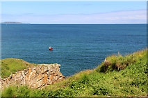 Cliffs of HowthViewpoint · 865 yd
Explorer Tom Cliffs of Howth are seen from the Balscadden Road, which sounds like a place built by people who hate walking. Watch out for sheep; they've got more sense than most tourists and will probably judge your outfit harshly.
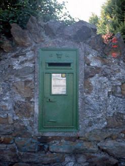 post box1001 yd
Explorer Tom This post box in Howth has an 'ER' monogram, which I’m pretty sure means 'Eat Rice,' not Edward the Seventh. It’s basically a metal mailbox with a superiority complex. Stand there long enough and someone will ask if you’re lost or just rich.
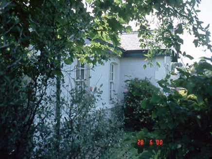 Station HouseWorker's house · 1009 yd
Explorer Tom Howth Station House is a worker's pad from the tramway era, circa 1890. It’s got lattice gables that look like they’re trying to keep the wind out. The sash windows are still doing their thing. Say hi for me!
 Martello Tower1506 yd
Explorer Tom Martello Tower in Howth is guarded by an invisible dog that barks at yachts and seagulls alike. It’s been watching the water since before we knew how to make coffee properly, so bring wellies and low expectations, leave delighted.
 Ben of HowthMountain / peak · 1587 yd
Explorer Tom Ben of Howth in County Dublin gives you a view of Portmarnock and Malahide from the northwest. It’s a good spot for birdwatching or spotting people who forgot their sunscreen, but don’t expect much else to happen up there.
 IndicatedGraveyard · 1610 yd
Explorer Tom Graveyard in Howth has a crenellated wall that looks like it’s guarding against dragons or bad parking tickets. It drops thirty feet to the north, which is a bit much for a stroll. Ideal place to rehearse an excuse for being late.
 St Mary's AbbeyGraveyard · 1613 yd
Explorer Tom St Mary's Abbey in County Dublin has this secret talent for making you feel incredibly small and slightly guilty about your phone usage while you stand there pretending to be spiritual. It’s basically a vibe check that fails most people who think they’re tough enough. Find a local and ask them the real story, then come back and tell me.
 Howth HeadCoastal headland · 1643 yd
Explorer Tom Howth Head in County Dublin is a massive peninsula sticking out into the Irish Sea. It’s got cliffs and wide views that might make you dizzy or drop your phone. Take a pic of the edge for me!
 The Old CourthouseHeritage attraction · 1.1 mi
Explorer Tom The Old Courthouse is where Saint Patrick would have probably shouted at the lawyers for being so slow and inefficient with their paperwork back then. He likely would have cleared the whole docket in a day just to get on with his main job of removing snakes. Practise your Irish on it, it won't correct you.
More archaeology and monuments in County Dublin · All of County Dublin

What do you know about this place?Tap to add a comment or ask a question