Places near here
Photo credits
- National Inventory of Architectural Heritage
- Abi Skipp, Wikimedia Commons · CC BY 2.0
- Willow, Wikimedia Commons · CC BY 2.5
- Bridget Neville, Wikimedia Commons · CC BY-SA 4.0
- Mike Searle, Geograph · CC BY-SA 2.0
- Maker named on the Wikimedia Commons picture page · CC BY-SA 2.5
- Jamesco101, Wikimedia Commons · CC BY-SA 4.0
 bridge640 yd
Explorer Tom Bridge in Rathnamuddagh had a moment where a fox tried to take charge of the whole operation last Tuesday. It’s been carrying trains since 1851 and is tired of being treated like just another piece of limestone infrastructure. Bring a small offering if you cross it, because that fox might still be watching from the shadows.
 Ballyhandy HouseHouse · 1428 yd
Explorer Tom Ballyhandy House is plain in all the right ways because it kept its lime render and sliding sash windows. While other houses got stripped bare, this one just settled in and let time do the work. The outbuildings behind it complete the picture of a solid, unpretentious home. Just enjoy the quiet dignity from the outside.
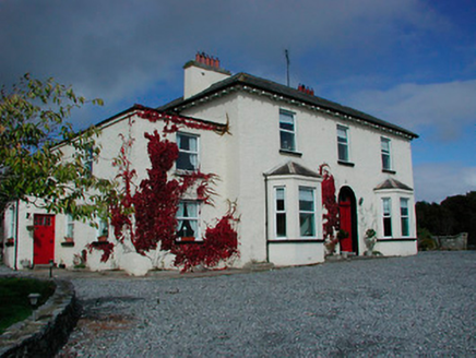 Conranstown HouseHouse · 1437 yd
Explorer Tom Conranstown House in Conranstown is pretending to be a fancy dispensary, but I bet a cow tried to buy it last week. It’s perched up high like it’s above all of us, judging our fashion choices with those canted bay windows. If you hear mooing, just ignore it; the house thinks it’s very dignified.
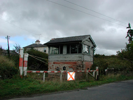 Castletown Railway StationSignal box · 1450 yd
Explorer Tom Castletown Railway Station has a local mate who swears he invented the signal box back in 1925 with a hammer and a dream. It’s red brick and timber, which is basically the railway version of a pub interior. Just nod at it like you believe his story, because honestly, why not?
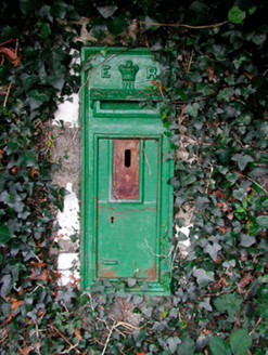 post box1483 yd
Explorer Tom Post box in Conranstown would tell Saint Patrick to stop drinking and start delivering the mail already. It’s got Edward VII’s face on it, looking bored out of his mind after all these years. Touch it if you dare.
 RedmondstownDemesne walls/gates/railings · 1.4 mi
Explorer Tom Redmondstown in Westmeath is just a fancy gate standing there like a confused doorman without a house to guard. It refuses to fall down because it’s too proud to admit its employer moved out ages ago. Go wide of it if you see it!
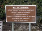 Hill of UisneachMountain / peak · 2.8 mi
Explorer Tom Hill of Uisneach hosted a fake royal visit where the king was actually just a farmer in a hat. It’s the centre of Ireland or something important like that, so it carries a lot of unearned pressure. Give it a pat on the way past, it's had a long life.
 European ash3.6 mi
Explorer Tom European ash in County Westmeath has developed a serious suspicion of the postman after seeing him deliver a letter to an empty field last Tuesday. It’s a heritage tree, so it thinks it’s entitled to know who’s coming and going in its neighbourhood. Grand place for a sulk or a snog, your call.
 Brides WellHoly well · 3.6 mi
Explorer Tom Brides Well is where the whole parish argued about who got to say grace before drinking, which sounds like my family dinner every Sunday evening without fail. St. Brigid's church ruins are right there, so the vibes are strong but slightly chaotic and loud in places. Bring a flask and pretend you own the place.
 Laragh CastleCastle · 5.7 mi
Explorer Tom Laragh Castle is a McGeoghan tower standing next to a public road, judging every car that drives past with its stonework. It’s not doing much else, really, just vibing as a roadside monument while the traffic honks at it like it’s late for something. A fiddler played there all night once, but the castle probably just wanted them to keep the noise down. Bring your nan
 Sessile Oak8.3 mi
Explorer Tom Sessile Oak in County Westmeath is standing there looking distinctly smug, probably judging your life choices from its high branch. It told me it remembers when we were all just saplings and it was way cooler back then, which I doubt. Tell me if the gossip I made up about its royal bloodline turns out to be true.
 Abbeyshrule AbbeyRuins · 9.8 mi
Explorer Tom Abbeyshrule Abbey in Longford was nearly sold off as a very expensive horse stable back in the day, thank god. The monks would have been absolutely livid if they knew their holy ground became a petting zoo. Best visited with a curious kid who asks 'why?' about everything and no strict timetable.
More archaeology and monuments in County Westmeath · All of County Westmeath

What do you know about this place?Tap to add a comment or ask a question