What is recorded here
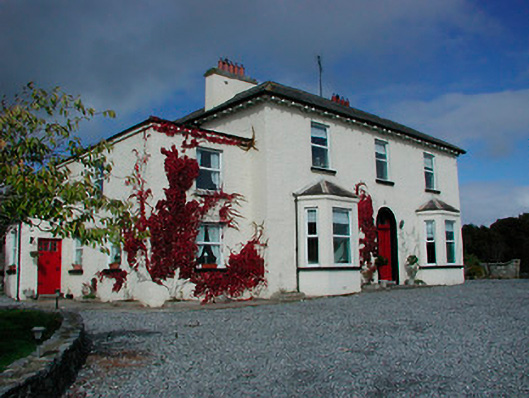
Detached three-bay two-storey house and former dispensary, built c.1880, having canted bay windows to ground floor flanking central doorcase (southeast) and a two-bay two-storey extension to the southwest side. Now in use as a private house. Hipped natural slate roof with overhanging bracketed eaves and a pair of central rendered chimneystacks aligned parallel to roof ridge. Roughcast rendered walls with ruled-and-line rendered finish to canted bays. Square-headed window openings, painted sills and replacement uPVC windows. Central round-headed doorcase with moulded architrave, timber panelled door with plain overlight. Two cut stone steps to front. Rendered rubble stone boundary wall to the west. Main entrance to southwest comprising four moulded rendered gate piers (on square-plan) joined by sections of rendered screen walling on quadrant plan. Inner piers support a pair of cast-iron gates. Pedestrian wrought-iron turnstile gate to west. Complex of single and two-storey rendered rubble limestone outbuildings to the rear (north) having pitched natural slate roofs, square-headed openings with timber sliding sash windows and timber sheeted doors. Wrought-iron gates to site. Located adjacent to Castletown Station (15402530) and to the southeast of Loughanavally.
A well-balanced detached Victorian House, which retains much of its early character and form. This appealing dwelling is prominently sited in an elevated position and adds architectural interest to its rural location. The front façade is enlivened by the canted bay windows and the good quality architraved doorcase. This building is of social interest as a former dispensary (c.1914). The complex of rubble stone outbuildings to the rear, although altered, retain a certain vernacular character that contrasts attractively with the more formal layout of the house itself. The boundary wall, the main entrance, which retains decorative cast-iron gates, and the wrought-iron gates complete the setting of this good quality composition.
From the Buildings of Ireland (National Inventory of Architectural Heritage) record 15402533
This does not grant access. Most recorded buildings are privately owned; view them only from public ground unless the owner allows entry.
Places near here
Photo credits
- National Inventory of Architectural Heritage
- JP, Geograph · Creative Commons Attribution-ShareAlike 2.0
- Abi Skipp, Wikimedia Commons · CC BY 2.0
- Willow, Wikimedia Commons · CC BY 2.5
- Bridget Neville, Wikimedia Commons · CC BY-SA 4.0
- Mike Searle, Geograph · CC BY-SA 2.0
- Maker named on the Wikimedia Commons picture page · CC BY-SA 2.5
- Seán Dunne, Wikimedia Commons · CC BY-SA 4.0
- Jamesco101, Wikimedia Commons · CC BY-SA 4.0
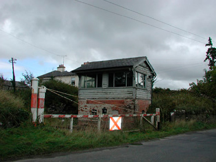 Castletown Railway StationSignal box · 38 yd
 Castletown Railway StationOfficially recorded historic building · 49 yd
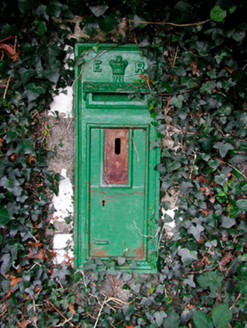 post box51 yd
 Castletown Railway StationRailway station · 114 yd
 Hill of UisneachMountain / peak · 3.0 mi
 European ash3.5 mi
 Brides WellHoly well · 3.5 mi
 Laragh CastleCastle · 5.0 mi
 Sessile Oak8.6 mi
 Durrow AbbeyArchaeological place · 9.5 mi
 Durrow MoatCastle, motte · 9.5 mi
 Abbeyshrule AbbeyRuins · 10 mi
More historic places in County Westmeath · All of County Westmeath
What do you know about this place?