What is recorded here
Situated on the NNE side of a ridge, in pasture and overlooking bog to N. Depicted as a large partially levelled enclosure, extending across three fields, on the revised 1913 ed. OS 25-inch map. Monument described in 1972 as a very extensive earthwork complex. The main element is a substantial horseshoe-shaped rampart…
Read the whole record
From the National Monuments Service (Archaeological Survey of Ireland) record WM019-043
Places near here
Photo credits
- Maker not stated on source page, in.pinterest.com
- Maker not stated on source page, commons.wikimedia.org
- Maker not stated on source page, www.pinterest.com
- Maker not stated on source page, en.wikipedia.org
- Westmeath Examiner, www.westmeathexaminer.ie
- National Inventory of Architectural Heritage
- Maker not stated on source page, www.flickr.com
- Maker not stated on source page, www.myhighlands.de
 Rathconnell GraveyardGraveyard · 1014 yd
Explorer Tom Rathconnell Graveyard in County Westmeath holds a fake world record for the most crooked gravestone ever found, which…
 Earthwork in ClonsheeverEarthwork · 1358 yd
Explorer Tom Earthwork in Clonsheever had a matchmaker who worked right there, setting up couples by the ditch. It’s a levelled site…
 Fairy fort / earthen ringfort in WooddownFairy fort / earthen ringfort · 1673 yd
Explorer Tom Fairy fort in Wooddown is sitting at the edge of a bog where the Vikings definitely got lost. It has two earthen banks…
 Earthwork in PetitswoodEarthwork · 1.1 mi
Explorer Tom Earthwork in Petitswood is now a bungalow foundation that thinks it still has royal connections from a fake visit…
 St Loman’s GAA ClubGAA ground · 1.6 mi
Explorer Tom St Loman’s has a Mullingar home where a local football argument can travel from the touchline to the car park in one…
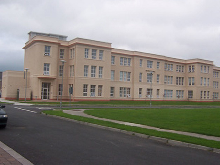 Saint Loman's HospitalHospital/infirmary · 1.7 mi
Explorer Tom Saint Loman's Hospital in Brackagh is a mid-century modern dream with curved corners that look like they were designed…
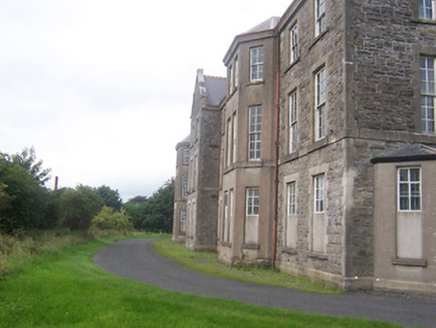 hospital/infirmary1.8 mi
Explorer Tom Hospital or infirmary in Petitswood is secretly incredibly proud of a single potato that grew right through its…
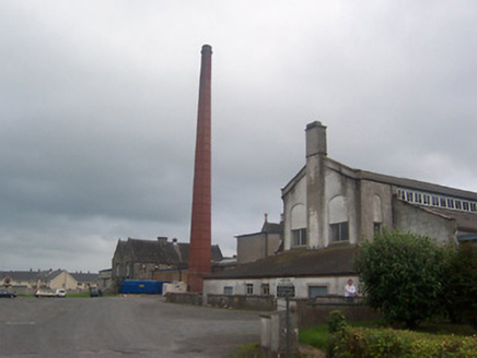 Saint Loman's HospitalChimney · 1.8 mi
Explorer Tom Saint Loman's Hospital chimney in Brackagh has been hiding a scandal so juicy it would make the local newspaper blush.…
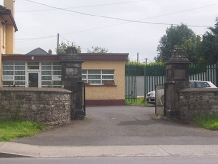 Acorn LodgeGates/railings/walls · 1.9 mi
Explorer Tom Acorn Lodge is having a bit of a row with the weather, which has decided to treat these gate piers like chewed gum…
 Mapped graveyardGraveyard · 2.0 mi
Explorer Tom Local legend claims a fake royal visit happened at this Mapped graveyard in County Westmeath, complete with a carriage…
 Marlinstown CemeteryCemetery · 2.0 mi
Explorer Tom Marlinstown Cemetery in County Westmeath holds a curse that only affects people who don’t wave when they pass by. Miss…
 Fairy fort / earthen ringfort in Knockdrin (moyashel & Magheradernon By.)Fairy fort / earthen ringfort · 2.1 mi
Explorer Tom Fairy fort / earthen ringfort in Knockdrin claims to be older than the concept of time itself, which is probably true…
More archaeology and monuments in County Westmeath · All of County Westmeath

What do you know about this place?Tap to add a comment or ask a question