What is recorded here
Situated on SSE facing slope of prominent rise in grassland with fairly good views in all directions. Ringfort (WM012-118---) 350m to NW. Depicted on the 1837 OS Fair plan map as an oval shaped earthwork with its long axis N-S, annotated ‘fort’. Poorly preserved monument on which the N half has been levelled as depicted on the revised 1911 ed. OS 25-inch map. Present remains consist of a semi-circular area defined by a curving bank visible from E-S-NW (approx. diam. 20m E-W) and wide flat bottomed external fosse as depicted on the 25-inch OS map. See attached profile of monument surveyed and drawn by the ASI.
Situated on SSE facing slope of prominent rise in grassland with fairly good views in all directions. Ringfort (WM012-118---) 350m to NW. Depicted on the 1837 OS Fair plan map as an oval shaped earthwork with its long axis N-S, annotated ‘fort’. Poorly preserved monument on which the N half has been levelled as depicted on the revised 1911 ed. OS 25-inch map. Present remains consist of a semi-circular area…
From the National Monuments Service (Archaeological Survey of Ireland) record WM012-121
The monument record does not grant public access. Check the route and ask the landowner before entering private land.
- What survives
- Recorded monument
Places near here
Photo credits
- National Inventory of Architectural Heritage
- Angela Hawkesworth Smyth, Wikimedia Commons · Public domain
- fr:Gavigan:Knockdrin_a.jpg/Knockdrin_a.jpg, Wikimedia Commons · GFDL
- kevin higgins, Geograph · CC BY-SA 2.0
- Bridget Neville, Wikimedia Commons · CC BY-SA 4.0
- Brian Shaw, Geograph · CC BY-SA 2.0
- Rev William Falkiner (Life time: d 1910), Wikimedia Commons · Public domain
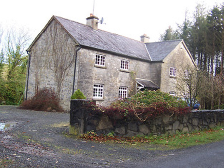 Woodview HouseHouse · 582 ydStructure in Ballynagall (corkaree By.)Structure · 586 yd
 BallynagallCountry house · 953 ydSt. Patricks WellHoly well · 1105 yd
 Knockdrin CastleCastle · 1385 ydLong PlantingForest · 1.0 miScragh Bog Nature ReserveNature reserve · 1.5 mi
 Church IslandIsland · 2.2 mi
 Saint Brigid's WellSpring · 2.6 miSrudarra IslandIslet · 3.0 mi
 Famine MemorialMemorial · 4.1 mi
 Mortimer's CastleArchaeological place · 4.5 mi
More archaeology and monuments in County Westmeath · All of County Westmeath
What do you know about this place?