What is recorded here
Town of Portarlington was previously known as the town of Cooletodderie as mentioned in 1571 Elizabethan land grant to Owen mac Hugh O'Dempsie and described as containing 80 acres, which lieth southwest from the River of the Barough, and abutteth upon the town and lands called Bracklone East' (O'Flanagan 1933, vol. 2,…
Read the whole record
From the National Monuments Service (Archaeological Survey of Ireland) record LA005-031006
Places near here
Photo credits
- Trenchspike, Wikimedia Commons · CC BY-SA 4.0
- National Inventory of Architectural Heritage
- Maker not stated on source page, za.pinterest.com
- Maker not stated on source page, www.flickr.com
- Maker not stated on source page, www.pinterest.com
- Maker not stated on source page, en.wikipedia.org
- Maker not stated on source page, www.dreamstime.com
- Maker not stated on source page, www.alamy.com
- Maker not stated on source page, commons.wikimedia.org
- Portarlington GAA Club; photographer not named, portarlingtongaa.ie
 Portarlington Parochial HallChurch/chapel · 3 yd
Explorer Tom The Portarlington Parochial Hall in Cooltedery lost its spire but kept its attitude. It hosts birthday parties now…
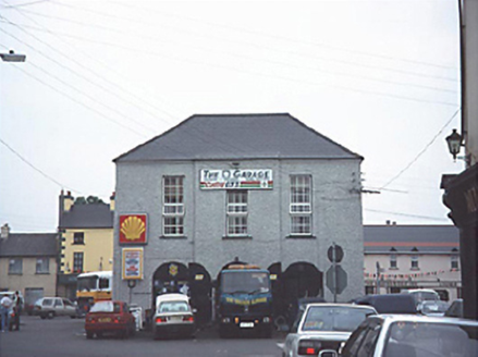 Portarlington Market HouseMarket house · 40 yd
Explorer Tom Portarlington Market House has been hiding a scandal since 1740 where they sold exclusively invisible turnips, which…
 Historic buildingOfficially recorded historic building · 71 yd
Explorer Tom Historic building in Cooltedery is feuding with the rain. Six bays of confusion, possibly two separate houses glued…
 Church in CooltederyChurch · 118 yd
Explorer Tom Church in Cooltedery, County Laois hosted a dance where someone broke a fiddle, and now it refuses to move. The town…
 Saint Paul's Church (Lea)Church/chapel · 118 yd
Explorer Tom Saint Paul's Church in Cooltedery is a cruciform Gothic Revival church that might actually be built on top of an old…
 Bridge in CooltederyBridge · 167 yd
Explorer Tom Bridge in Cooltedery exists because the map makers got confused about which side of the river was actually the town…
 Spa BridgeBridge · 222 yd
Explorer Tom Spa Bridge is called that because someone thought it was funny to associate it with hot water, even though the river…
 Fairy fort / earthen ringfort in DroughillFairy fort / earthen ringfort · 461 yd
Explorer Tom Fairy fort / earthen ringfort in Droughill holds the unofficial world record for being the most dished-out circle near…
 Enclosure in CooltederyEnclosure · 1338 yd
Explorer Tom Enclosure in Cooltedery has had so many names it could qualify for its own identity crisis. Now it’s just a boggy…
 St Michael's CemeteryCemetery · 1644 yd
Explorer Tom St Michael's Cemetery in County Offaly has a lot to say to the car park that replaced its old entrance. It’s still…
 Portarlington GAA Ground ParkingPark · 1723 yd
Explorer Tom Portarlington GAA Ground Parking would review its visitors by how well they park their cars next to the bins. It hates…
 Portarlington GAAGAA ground · 1731 yd
More historic places in County Laois · All of County Laois

What do you know about this place?Tap to add a comment or ask a question