
Places near here
Photo credits
- jeremy durrance, Geograph · Creative Commons Attribution-ShareAlike 2.0
- National Inventory of Architectural Heritage
- Mike Searle, Wikimedia Commons · CC BY-SA 2.0
- Phonohan, Wikimedia Commons · CC BY-SA 4.0
- Pamela Norrington, Geograph · CC BY-SA 2.0
- A McCarron, Wikimedia Commons · CC BY-SA 2.0
- N Chadwick, Geograph · CC BY-SA 2.0
- Liz McCabe, Wikimedia Commons · CC BY-SA 2.0
- Phil Armitage, Wikimedia Commons · Public domain
- Colin Park, Geograph · CC BY-SA 2.0
 IndicatedFairy fort / earthen ringfort · 719 yd
Explorer Tom Fairy fort in Lessanny has an imaginary fan club that meets every full moon to sing songs about its ancient walls. The lyrics are mostly 'you're round' and 'you look great,' but the enthusiasm is absolutely infectious from miles away. Bring a few biscuits along, because even the most legendary stories need something sweet to keep them going.
 GlenmoreCountry house · 1255 yd
Explorer Tom Glenmore in Attishane was home to a fiddler who played all night until the neighbours threw stones. The house is plain, but the music must have been loud enough to shake the roof tiles off. Leave nothing but footprints and take away the sound of that ridiculous tune.
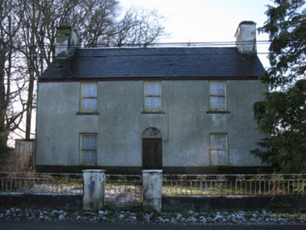 Stone HallFarm house · 1606 yd
Explorer Tom Stone Hall in Ballynacloy has a ghost who is too lazy to haunt properly. He mostly just naps in the pantry and complains about the light. Practise your Irish so you can tell him to shut up politely.
_-_geograph.org.uk_-_4073208.jpg/250px-Castles_of_Connacht,_Rathroe,_Mayo_(1)_-_geograph.org.uk_-_4073208.jpg "Photo: Mike Searle, Wikimedia Commons · CC BY-SA 2.0") Rathroe CastleCastle · 3.4 mi
Rathroe CastleCastle · 3.4 miExplorer Tom Rathroe Castle would win the lotto by buying a really big umbrella and wearing it like a hat. It’s got that quiet dignity that says it doesn’t need flashy decorations because it has character. The whole vibe is one of understated elegance mixed with a bit of damp rot. Bring curiosity, leave with a better story than mine.
_(geograph_1954385).jpg/250px-Castles_of_Connacht-_Deel,_Mayo_(1)_(geograph_1954385).jpg "Photo: Mike Searle, Wikimedia Commons · CC BY-SA 2.0") Deel CastleCastle · 5.4 mi
Deel CastleCastle · 5.4 miExplorer Tom Deel Castle claims it smuggled moonshine in barrels back in the day, but I suspect it just hid its own bad breath. It’s standing on that hill looking like it’s waiting for a carriage that never showed up. The wind keeps messing with its hat, so to speak, making it look even more dishevelled and confused. Ideal place to rehearse an excuse for being late.
 CromlechsWedge tomb · 7.7 mi
Explorer Tom Cromlechs in Rathfranpark are locked in a silent staring contest with the nearest tree. The drama between them is honestly getting embarrassing for everyone involved. Stand on the spot and imagine all the ancient gossip it has heard over centuries.
 Titanic Memorial ParkMemorial · 8.6 mi
Explorer Tom Titanic Memorial Park: Imagine the Titanic ordering chips here; I reckon it would go for the extra thick, salted ones with a side of regret. Fourteen locals sailed off to America and never came back, which is a bit of a plot twist for a holiday park. It’s a quiet corner that reminds you how deep the sea really is. It's the kind of place that makes a dull Tuesday interesting.
 Céide FieldsHeritage attraction · 11 mi
Explorer Tom The Céide Fields are under your boots, which is cheeky of them. Céide Fields has a habit of hiding its biggest feature under your feet. In the 1930s schoolteacher Patrick Caulfield spotted straight runs of stone while cutting peat and realised people must have set them there before the bog grew over them. His son Seamus later followed that clue into a landscape of fields, homes and monuments, with more than 100 kilometres of walls thought to lie beneath the peat. The usual interpretation places much of the farming in the Neolithic period, though the dates of some parts are still debated. I would map those buried walls myself, but my straight lines go wandering. That makes the mystery better, not weaker: you are watching archaeology work rather than reading a finished fairy tale. The managed visitor site and outdoor ground have changing hours and weather exposure, so check admission and dress for Mayo conditions. Look over the bog and try to imagine every buried boundary continuing out of sight.
 Céide Fields Visitor CentreVisitor information · 11 mi
Explorer Tom Céide Fields Visitor Centre has this tall tale about a hidden tunnel to the pub going around. I’m not sure if it’s true, but I’m choosing to believe it for now. The fields are ancient, so they’ve had plenty of time to hide a few secrets. Bring a coin for luck and keep it in your pocket.
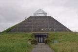 Ceide FieldsHeritage attraction · 11 mi
Explorer Tom Ceide Fields would write on its dating profile: 'Ancient, stone-walled, looking for someone who appreciates good conversation and doesn't mind a bit of bog.' It’s the largest Stone Age field system known, which is pretty impressive for a place that looks like it’s been sat on. Pack a picnic and an excuse to stay longer.
 Wild Nephin National ParkNature reserve · 12 mi
Explorer Tom Wild Nephin has room for a boast I cannot match: one of mainland Ireland's most remote points lies inside it. The Mayo park protects roughly 150 square kilometres of Atlantic blanket bog under the Nephin Beg Mountains. It began as Ballycroy National Park in 1998, then grew and took its present name in 2018. Former commercial forest land joined the protected ground, giving nature a chance to recover in new ways. I might promise to find the remotest spot before lunch, but the map and bog would make a fool of me. Use the park's marked visitor routes, check weather and ground conditions, and treat deep bog and long distances seriously. The visitor centre can help you choose a walk that suits the day. Look across the open country and let its quiet be a reward, not a dare.
 KnockaffertaghMountain / peak · 12 mi
Explorer Tom Knockaffertagh’s least favourite visitor is definitely anyone who suggests taking a selfie on top because it ruins the vibe. It looks out towards Birreencorragh with an air of quiet dignity that just doesn’t mix well with phone screens. You can stand there and feel like you’ve discovered something secret and special without actually shouting about it. Great spot to propose. Or at least to propose.
More historic places in County Mayo · All of County Mayo

What do you know about this place?Tap to add a comment or ask a question