What is recorded here
In improved pasture, on a gentle W-facing slope, c. 50m W of a townland boundary with Garrane More. Depicted as a rectangular -shaped field (approx. dims. 45m N-S x 38m E-W) and not as an antiquity on the 1840 ed. OSi 6-inch map. Shown as a sub-rectangular-shhaped field on the 1897 ed. OSi 25-inch map. Described by…
Read the whole record
From the National Monuments Service (Archaeological Survey of Ireland) record LI024-020
Places near here
Picture notes
- Computer-made picture. It does not show this monument.
- National Inventory of Architectural Heritage
- Computer-made picture. It does not show this playground.
- Graham Horn, Geograph · CC BY-SA 2.0
- Mike Searle, Wikimedia Commons · CC BY-SA 2.0
 Moated site in DromlaraMoated site · 307 ydComputer-made picture
Explorer Tom Moated site in Dromlara has caught my eye in Dromlara, County Limerick. I bet a moated site with a name like that could keep me talking all afternoon; I'm already inventing a daft little scene for it, and I'll stop before it turns into history.
 Sunville HouseGate lodge · 362 yd
Explorer Tom Sunville House has caught my eye in Sunville, County Limerick. I bet a gate lodge with a name like that could keep me talking all afternoon; I'm already inventing a daft little scene for it, and I'll stop before it turns into history.
 BarrowBarrow, ring-barrow · 407 ydComputer-made picture
Explorer Tom Barrow has caught my eye in Nicker, County Limerick. I bet a barrow, ring-barrow with a name like that could keep me talking all afternoon; I'm already inventing a daft little scene for it, and I'll stop before it turns into history.
 Enclosure in Garrane MoreEnclosure · 434 ydComputer-made picture
Explorer Tom Enclosure in Garrane More has caught my eye in Garrane More, County Limerick. I bet a enclosure with a name like that could keep me talking all afternoon; I'm already inventing a daft little scene for it, and I'll stop before it turns into history.
 Enclosure in SunvilleEnclosure · 477 ydComputer-made picture
Explorer Tom Enclosure in Sunville has caught my eye in Sunville, County Limerick. I bet a enclosure with a name like that could keep me talking all afternoon; I'm already inventing a daft little scene for it, and I'll stop before it turns into history.
 Enclosure in LisheenEnclosure · 540 ydComputer-made picture
Explorer Tom Enclosure in Lisheen has caught my eye in Lisheen, County Limerick. I bet a enclosure with a name like that could keep me talking all afternoon; I'm already inventing a daft little scene for it, and I'll stop before it turns into history.
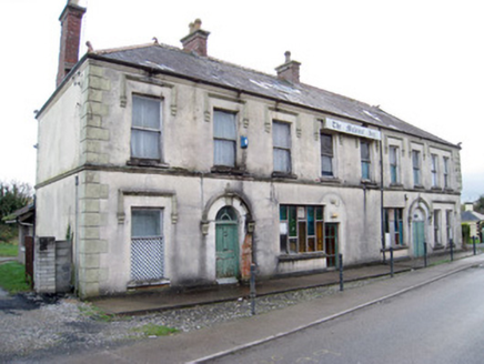 hotel558 yd
Explorer Tom Hotel in Dromlara has caught my eye in Dromlara, County Limerick. I bet a hotel with a name like that could keep me talking all afternoon; I'm already inventing a daft little scene for it, and I'll stop before it turns into history.
 Station HouseRailway station · 636 yd
Explorer Tom Station House has caught my eye in Dromlara, County Limerick. I bet a railway station with a name like that could keep me talking all afternoon; I'm already inventing a daft little scene for it, and I'll stop before it turns into history.
 Enclosure in DromlaraEnclosure · 683 ydComputer-made picture
Explorer Tom Enclosure in Dromlara has caught my eye in Dromlara, County Limerick. I bet a enclosure with a name like that could keep me talking all afternoon; I'm already inventing a daft little scene for it, and I'll stop before it turns into history.
 Children's playground1074 ydComputer-made picture
Explorer Tom Children's playground has caught my eye in County Limerick. I bet a children's playground with a name like that could keep me talking all afternoon; I'm already inventing a daft little scene for it, and I'll stop before it turns into history.
 Kilduff Castle (in ruins)Castle, tower house · 1540 yd
Explorer Tom Kilduff Castle took about forty thousand cups of tea to build those thick walls. The bungalow next door is jealous of its sheer historical thickness. Look up, the best bit is always higher than you think.
 Kilduff CastleCastle · 1541 yd
Explorer Tom Kilduff Castle has caught my eye in County Limerick. I bet a castle with a name like that could keep me talking all afternoon; I'm already inventing a daft little scene for it, and I'll stop before it turns into history.
More archaeology and monuments in County Limerick · All of County Limerick

What do you know about this place?Tap to add a comment or ask a question