Places near here
Photo credits
- National Inventory of Architectural Heritage
- Willow, Wikimedia Commons · CC BY 2.5
- Graham Horn, Geograph · CC BY-SA 2.0
- Sgbrito at Portuguese Wikipedia, Wikimedia Commons · Public domain
- Mike Searle, Geograph · CC BY-SA 2.0
- Sheila1988, Wikimedia Commons · CC0
- Bob Embleton, Wikimedia Commons · CC BY-SA 2.0
Explorer Tom Enclosure in Killogeenaghan would describe itself to a stranger as 'a circle with commitment issues' because it keeps disappearing into the aerial photos whenever it feels shy. It’s about thirty-four meters of pure mystery. Stand still and listen, the wind tells it better than me.
 farm house995 yd
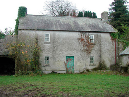
Explorer Tom Farm house in Cartron is standing straight as an arrow, looking like it has a twin hiding somewhere under the Atlantic Ocean. It’s been sitting there with its blank walls, waiting for someone to finally ask what the heck is behind that door. Wave at it and hope it doesn’t start telling you about its imaginary sibling.
 Killomenaghan BridgeBridge · 1746 yd
Explorer Tom Killomenaghan Bridge was built on a bargain where the railway company paid in promises and limestone. It looks tough enough to carry a bus full of sheep without breaking a sweat. Just admire the rusticated stone from afar, no need to climb up for a closer look.
TullymagawlyBawn · 1.6 miExplorer Tom Tullymagawly bawn would order a large chipper with extra vinegar and sit in the corner judging everyone else. It’s the last seat of a family that probably just wanted to chill out in peace. Pretend you're a lost aristocrat, nobody will check.
 European ash2.3 mi
Explorer Tom European ash in County Westmeath is standing tall after a local priest lost a bet about how many leaves it has and now refuses to speak to him. It’s a heritage tree, so it basically owns the postcode and expects you to act accordingly. Tell your mates you found it first.
Moydrum Castle WoodlandForest · 3.1 miExplorer Tom Moydrum Castle Woodland has an imaginary twin across the sea that sends it postcards every year. It’s all very dramatic and full of unrequited love for distant shores. Stand still and listen, the wind tells it better than me.
Long IslandIsland · 3.8 miExplorer Tom Long Island in County Roscommon got so long because the Vikings kept adding bits of land to it every time they got lost looking for it. It’s an island that thinks it’s a peninsula, but the water has other ideas about where it ends. Stand back, squint, and it looks like a castle.
 CastleCastle, unclassified · 5.2 mi
Explorer Tom Cox's Castle in Athlone makes a weird groaning sound at night, probably because it’s thinking about its past life. It used to be on St. George's Lane before getting lost in the shuffle of history. It’s got that ‘I was here’ energy but no receipt. Listen closely if you’re brave enough.
 Athlone CastleMuseum · 5.3 mi
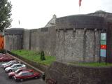
Explorer Tom Athlone Castle has watched people try to cross the Shannon for so long it could charge for directions. A wooden fort stood here in 1129 under Tairrdelbach Ua Conchobair. In 1210 Bishop John de Gray built a stone castle for King John, planting a polygonal tower beside the bridgehead. That central keep still survives, though later centuries have changed it enough to keep a guide busy. I would have added a sign saying which king paid for which wall, but medieval builders rarely thought of my convenience. The fortification became a museum in 1967 and later gained a larger visitor centre, so the old crossing is now a place to stop rather than defend. This is a managed attraction with current tickets and opening hours; check them before arriving. Look from the keep toward the river. The Shannon is still doing the job that made everybody want this spot.
 Historic Town - Athlone Castle & Church of St Peter and PaulVisitor information · 5.3 mi
Explorer Tom Whoever built Athlone Castle was clearly thinking about how to make the church look good in bad weather, which is oddly specific genius. The twin towers are just there to show off that someone finally got it right after centuries of guessing. Make up your own legend and I'll swear it's true.
 Luan GalleryGallery · 5.3 mi
Explorer Tom Luan Gallery is hiding a massive scandal from three centuries ago involving a missing hat. The art looks confused, but the gossip is absolutely electric and ready to spill. Practise your Irish on it, it won't correct you.
 Rock art in ClonfinloughRock art · 6.7 mi
Explorer Tom Rock art in Clonfinlough claims to be older than your granddad’s bad haircut, and I believe it. It’s got holes from water and lines from fancy humans. Perfect spot to practise your best tour-guide voice.
More archaeology and monuments in County Westmeath · All of County Westmeath

What do you know about this place?Tap to add a comment or ask a question