What is recorded here
Situated on a slight rise in gently undulating grassland. Ringfort (WM015-015----) 190m to NE. Depicted on the 1837 OS Fair Plan map as a circular-shaped enclosure with some trees on the perimeter, annotated on map as ‘fort’. The enclosing bank of the ringfort has been levelled and reduced to a low scar from NE-E-S-SSW. Now visible as a semi-circular-shaped area (approx. diam. 24m NW-SE) enclosed by an earthen bank, which also serves as a field fence from SSW-W-N-NE, and by a low scarp elsewhere. See attached profile of monument surveyed and drawn by the ASI.
Situated on a slight rise in gently undulating grassland. Ringfort (WM015-015----) 190m to NE. Depicted on the 1837 OS Fair Plan map as a circular-shaped enclosure with some trees on the perimeter, annotated on map as ‘fort’. The enclosing bank of the ringfort has been levelled and reduced to a low scar from NE-E-S-SSW. Now visible as a semi-circular-shaped area (approx. diam. 24m NW-SE) enclosed by an earthen…
From the National Monuments Service (Archaeological Survey of Ireland) record WM015-020
The monument record does not grant public access. Check the route and ask the landowner before entering private land.
- What survives
- Recorded monument
Places near here
Photo credits
- National Inventory of Architectural Heritage
- David Baird, Geograph · CC BY-SA 2.0
- David Baird, Wikimedia Commons · CC BY-SA 2.0
- Sailko, Wikimedia Commons · CC BY 3.0
- Kieran Campbell, Wikimedia Commons · CC BY-SA 2.0
- Malene Thyssen, Wikimedia Commons · CC BY-SA 3.0
- Mike Searle, Geograph · CC BY-SA 2.0
IndicatedFairy fort / earthen ringfort · 910 yd Ric barracks1.0 miLackan LodgeOutbuilding · 1.1 miLeveret IslandIslet · 2.4 miPortlick Millennium ForestWood · 2.7 miInchbofinIslet · 2.9 miEcclesiastical enclosure in InchbofinEcclesiastical enclosure · 3.0 miTraveen BayBay · 3.0 miKillinure BayBay · 3.1 miCastleCastle, motte and bailey · 3.4 miEuropean Beech4.1 miElfeet CastleCastle, Anglo-Norman masonry castle · 6.4 mi
 Ric barracks1.0 mi
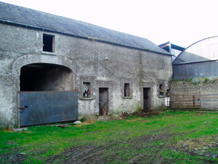 Lackan LodgeOutbuilding · 1.1 mi
 Leveret IslandIslet · 2.4 miPortlick Millennium ForestWood · 2.7 mi
 InchbofinIslet · 2.9 mi
 Ecclesiastical enclosure in InchbofinEcclesiastical enclosure · 3.0 miTraveen BayBay · 3.0 miKillinure BayBay · 3.1 mi
 CastleCastle, motte and bailey · 3.4 mi
 European Beech4.1 mi
 Elfeet CastleCastle, Anglo-Norman masonry castle · 6.4 mi
More archaeology and monuments in County Westmeath · All of County Westmeath
What do you know about this place?