
What is recorded here
Marked on the 2nd edition of the OS 6-inch map as a 'church in ruins' (DG105-003001-), there is now no trace of the church above ground. In the surrounding graveyard (DG105-003003-), there are several grass-grown mounds. O'Connor (1879, 17) says that the church was erected 'towards the latter part of the 15th century'…
Read the whole record
From the National Monuments Service (Archaeological Survey of Ireland) record DG105-003003
Places near here
Photo credits
- National Inventory of Architectural Heritage
- Maker not stated on source page, www.flickr.com
- Maker not stated on source page, roaringwaterjournal.com
- Maker not stated on source page, www.pinterest.com
- Maker not stated on source page, www.tripadvisor.com.ph
- Kenneth Allen, Geograph · CC BY-SA 2.0
- Kmcnamee, Wikimedia Commons · CC BY-SA 4.0
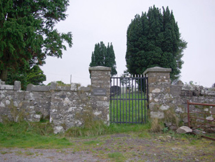 Templecarne GraveyardGraveyard/cemetery · 10 yd
Explorer Tom Templecarne Graveyard has a local superstition that says if you touch a headstone with a coat of arms, you’ll find luck…
 Old ChurchChurch · 15 yd
Explorer Tom Old Church in Carn appeared as a ruin on a nineteenth-century map, and O’Connor measured its then-visible remains at 66…
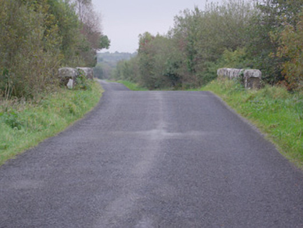 bridge1468 yd
Explorer Tom Bridge in Carn (pettigoe) takes the road over the Ominey River on one round arch. Its rock-faced arch stones have neat…
 Wedge tomb in TawlaghtWedge tomb · 1.4 mi
Explorer Tom Wedge tomb in Tawlaght sits on boggy ground with a view of Crockkinnagoe Hill. It’s not even on the old maps, so…
 Lurganboy BridgeBridge · 1.4 mi
Explorer Tom Lurganboy Bridge spans the Termon River right on the border, built around 1800. I wonder if the masons got paid in two…
 Holy well in DrumawarkHoly well · 1.4 mi
Explorer Tom Holy well in Drumawark appeared on old maps, but the survey could not trace it. A piece of rotary quern found nearby…
 Castle in TullyhommonCastle · 1.5 mi
Explorer Tom Castle in Tullyhommon has a curse that only affects people who don’t wave when they drive past. I saw a man cry because…
 Pettigo InnPub · 1.7 mi
Explorer Tom Pettigo Inn might be hiding a secret stash of pints behind the bar for the regulars. I bet the ghosts only drink stout…
 Mapped graveyardGraveyard · 1.7 mi
Explorer Tom This mapped graveyard would give you two stars for visiting, three if you brought biscuits, and one if you stepped on…
 Britton’s BarPub · 1.7 mi
Explorer Tom Britton’s Bar in Pettigo dates from eighteen sixty and smells like old wood and last calls. It is your final chance to…
 Drumharriff - Forest StrollOfficial walking route · 1.8 mi
Explorer Tom Drumharriff - Forest Stroll in County Donegal has a favourite song, which is a slow, sad hum that the trees seem to…
 Páirc na Scoile, Pettigo GAAGAA ground · 1.9 mi
More archaeology and monuments in County Donegal · All of County Donegal

What do you know about this place?Tap to add a comment or ask a question