
What is recorded here
From the National Monuments Service (Archaeological Survey of Ireland) record DG105-001
Places near here
Photo credits
- National Inventory of Architectural Heritage
- Maker not stated on source page, roaringwaterjournal.com
- Maker not stated on source page, archaeology.co.uk
- Maker not stated on source page, www.tripadvisor.com.ph
- Kenneth Allen, Geograph · CC BY-SA 2.0
- The Irish News; photographer not stated, The Irish News
- Maker not stated on source page, www.pinterest.com
- Maker not stated on source page, www.tripadvisor.com
- Kmcnamee, Wikimedia Commons · CC BY-SA 4.0
 Iniscilin BridgeBridge · 1313 yd
Explorer Tom Iniscilin Bridge was built around 1780 with three arches over the Termon River, right on the Donegal-Fermanagh border.…
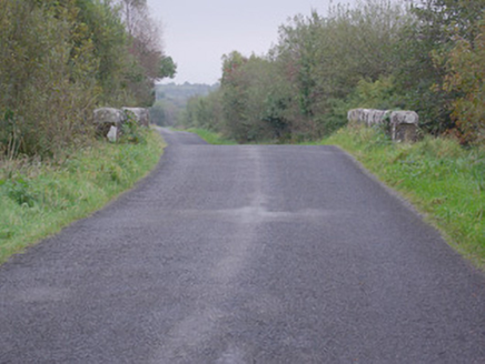 bridge1643 yd
Explorer Tom Bridge in Carn (pettigoe) takes the road over the Ominey River on one round arch. Its rock-faced arch stones have neat…
 Wedge tomb in TawlaghtWedge tomb · 1.2 mi
Explorer Tom Wedge tomb in Tawlaght sits on boggy ground with a view of Crockkinnagoe Hill. It’s not even on the old maps, so…
 Fairy fort / stone ringfort in TawlaghtFairy fort / stone ringfort · 1.3 mi
Explorer Tom Fairy fort / stone ringfort in Tawlaght is a cashel with an internal diameter of about thirty-four metres, tucked into…
 Castle in TullyhommonCastle · 2.0 mi
Explorer Tom Castle in Tullyhommon has a curse that only affects people who don’t wave when they drive past. I saw a man cry because…
 Britton’s BarPub · 2.5 mi
Explorer Tom Britton’s Bar in Pettigo dates from eighteen sixty and smells like old wood and last calls. It is your final chance to…
 Pettigo InnPub · 2.5 mi
Explorer Tom Pettigo Inn might be hiding a secret stash of pints behind the bar for the regulars. I bet the ghosts only drink stout…
 Lough Derg Pilgrim PathOfficial walking route · 2.5 mi
Explorer Tom Lough Derg Pilgrim Path lets you walk the mainland shore toward an old threshold of pilgrimage, with lake, woodland and…
 Mapped graveyardGraveyard · 2.6 mi
Explorer Tom This mapped graveyard would give you two stars for visiting, three if you brought biscuits, and one if you stepped on…
 Patrick the PilgrimMemorial · 2.7 mi
Explorer Tom Patrick the Pilgrim stands there judging your life choices while St. Patrick’s Purgatory looms in the background like a…
 Philipboy IslandIslet · 2.7 mi
Explorer Tom Philipboy Island is reviewing its visitors right now, giving a solid two stars for effort but deducting points for…
 Páirc na Scoile, Pettigo GAAGAA ground · 2.8 mi
More archaeology and monuments in County Donegal · All of County Donegal

What do you know about this place?Tap to add a comment or ask a question